Cuates School Topo Map New Mexico
To zoom in, hover over the map of Cuates School
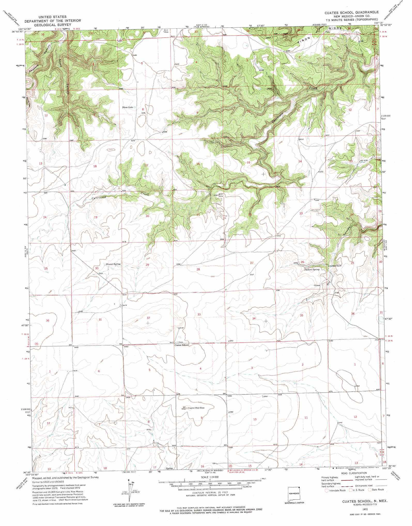
USGS Topo Quad 36103g3 - 1:24,000 scale
| Topo Map Name: | Cuates School |
| USGS Topo Quad ID: | 36103g3 |
| Print Size: | ca. 21 1/4" wide x 27" high |
| Southeast Coordinates: | 36.75° N latitude / 103.25° W longitude |
| Map Center Coordinates: | 36.8125° N latitude / 103.3125° W longitude |
| U.S. State: | NM |
| Filename: | o36103g3.jpg |
| Download Map JPG Image: | Cuates School topo map 1:24,000 scale |
| Map Type: | Topographic |
| Topo Series: | 7.5´ |
| Map Scale: | 1:24,000 |
| Source of Map Images: | United States Geological Survey (USGS) |
| Alternate Map Versions: |
Cuates School NM 1972, updated 1974 Download PDF Buy paper map Cuates School NM 2010 Download PDF Buy paper map Cuates School NM 2013 Download PDF Buy paper map Cuates School NM 2017 Download PDF Buy paper map |
1:24,000 Topo Quads surrounding Cuates School
Cobert Mesa North |
Jesus Canyon |
Dennis Canyon |
Furnish Canyon West |
Furnish Canyon East |
Cobert Mesa South |
Travesser Park |
Tub Spring |
Wedding Cake Butte |
Goodson School |
Fiddler Springs |
Guy |
Cuates School |
Atencio |
Greendailey Canyon |
Blind Gap |
Boiler Gap |
Mclaughlin Bridge |
Seneca |
Moses |
Grenville |
Mount Dora |
Bible Top Butte |
Rabbit Ear Mountain |
Rardin Hill |
> Back to 36103e1 at 1:100,000 scale
> Back to 36102a1 at 1:250,000 scale
> Back to U.S. Topo Maps home
Cuates School topo map: Gazetteer
Cuates School: Lakes
Stone Lake elevation 1640m 5380′Cuates School: Populated Places
Cuates (historical) elevation 1651m 5416′Cuates School: Post Offices
Cuates Post Office (historical) elevation 1651m 5416′Cuates School: Springs
Bruner Spring elevation 1640m 5380′Pacheco Spring elevation 1587m 5206′
Cuates School: Valleys
Stone Canyon elevation 1532m 5026′Cuates School digital topo map on disk
Buy this Cuates School topo map showing relief, roads, GPS coordinates and other geographical features, as a high-resolution digital map file on DVD: