Wedding Cake Butte Topo Map New Mexico
To zoom in, hover over the map of Wedding Cake Butte
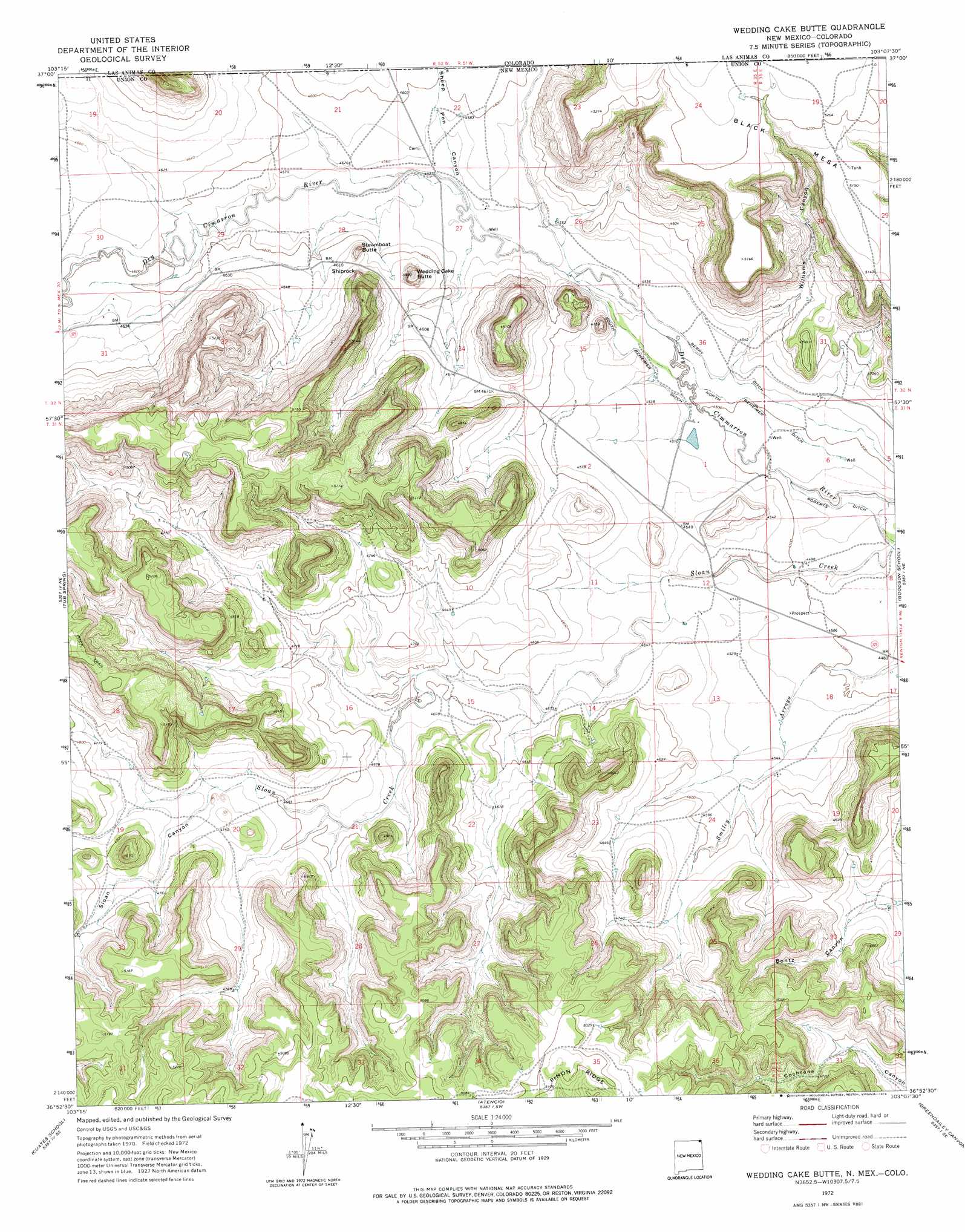
USGS Topo Quad 36103h2 - 1:24,000 scale
| Topo Map Name: | Wedding Cake Butte |
| USGS Topo Quad ID: | 36103h2 |
| Print Size: | ca. 21 1/4" wide x 27" high |
| Southeast Coordinates: | 36.875° N latitude / 103.125° W longitude |
| Map Center Coordinates: | 36.9375° N latitude / 103.1875° W longitude |
| U.S. States: | NM, CO |
| Filename: | o36103h2.jpg |
| Download Map JPG Image: | Wedding Cake Butte topo map 1:24,000 scale |
| Map Type: | Topographic |
| Topo Series: | 7.5´ |
| Map Scale: | 1:24,000 |
| Source of Map Images: | United States Geological Survey (USGS) |
| Alternate Map Versions: |
Wedding Cake Butte NM 1972, updated 1974 Download PDF Buy paper map Wedding Cake Butte NM 2010 Download PDF Buy paper map Wedding Cake Butte NM 2013 Download PDF Buy paper map Wedding Cake Butte NM 2017 Download PDF Buy paper map |
1:24,000 Topo Quads surrounding Wedding Cake Butte
Dalerose Mesa |
Kim South |
Pintada Creek |
Carrizo Mountain |
Reader Lake |
Jesus Canyon |
Dennis Canyon |
Furnish Canyon West |
Furnish Canyon East |
Big Hole Canyon |
Travesser Park |
Tub Spring |
Wedding Cake Butte |
Goodson School |
Kenton |
Guy |
Cuates School |
Atencio |
Greendailey Canyon |
Kenton Sw |
Boiler Gap |
Mclaughlin Bridge |
Seneca |
Moses |
Wheeless |
> Back to 36103e1 at 1:100,000 scale
> Back to 36102a1 at 1:250,000 scale
> Back to U.S. Topo Maps home
Wedding Cake Butte topo map: Gazetteer
Wedding Cake Butte: Canals
Berry Ditch elevation 1379m 4524′South Beheimer Ditch elevation 1377m 4517′
Wedding Cake Butte: Ridges
Piñon Ridge elevation 1564m 5131′Wedding Cake Butte: Slopes
Shiprock elevation 1434m 4704′Wedding Cake Butte: Summits
Black Mesa elevation 1597m 5239′Steamboat Butte elevation 1428m 4685′
Wedding Cake Butte elevation 1483m 4865′
Wedding Cake Butte: Valleys
Bontz Canyon elevation 1416m 4645′Sheep Pen Canyon elevation 1390m 4560′
Sheep Pen Canyon elevation 1389m 4557′
Sloan Canyon elevation 1438m 4717′
Williams Canyon elevation 1386m 4547′
Wedding Cake Butte digital topo map on disk
Buy this Wedding Cake Butte topo map showing relief, roads, GPS coordinates and other geographical features, as a high-resolution digital map file on DVD: