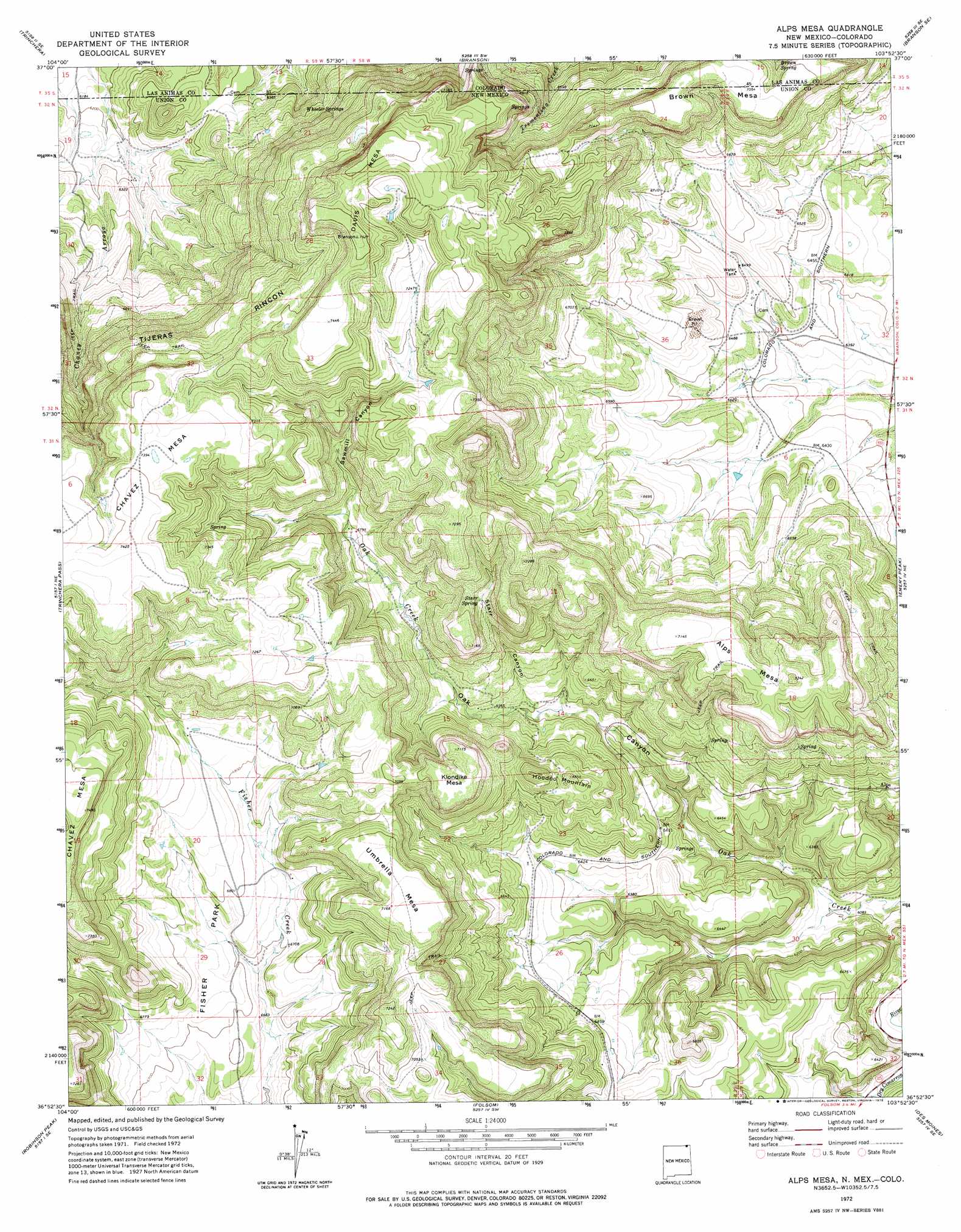
Alps Mesa Topo Map New Mexico
To zoom in, hover over the map of Alps Mesa
USGS Topo Quad 36103h8 - 1:24,000 scale
| Topo Map Name: | Alps Mesa |
| USGS Topo Quad ID: | 36103h8 |
| Print Size: | ca. 21 1/4" wide x 27" high |
| Southeast Coordinates: | 36.875° N latitude / 103.875° W longitude |
| Map Center Coordinates: | 36.9375° N latitude / 103.9375° W longitude |
| U.S. States: | NM, CO |
| Filename: | o36103h8.jpg |
| Download Map JPG Image: | Alps Mesa topo map 1:24,000 scale |
| Map Type: | Topographic |
| Topo Series: | 7.5´ |
| Map Scale: | 1:24,000 |
| Source of Map Images: | United States Geological Survey (USGS) |
| Alternate Map Versions: |
Alps Mesa NM 2010 Download PDF Buy paper map Alps Mesa NM 2013 Download PDF Buy paper map Alps Mesa NM 2017 Download PDF Buy paper map |
1:24,000 Topo Quads surrounding Alps Mesa
Patterson Crossing |
Trinchera Cave |
Trementina Canyon |
Box Ranch |
Miners Peak |
Abeyta |
Trinchera |
Branson |
Branson Se |
Pine Canyon |
Dale Mountain |
Trinchera Pass |
Alps Mesa |
Emery Peak |
Cross L Ranch |
Johnson Park |
Robinson Peak |
Folsom |
Des Moines |
Cross L Ranch Sw |
Mesa Larga |
Kiowa |
Capulin |
Little Grande |
Wetherly Lake |
> Back to 36103e1 at 1:100,000 scale
> Back to 36102a1 at 1:250,000 scale
> Back to U.S. Topo Maps home
Alps Mesa topo map: Gazetteer
Alps Mesa: Mines
San Miguel Mine elevation 2088m 6850′Alps Mesa: Parks
Fisher Park elevation 2057m 6748′Alps Mesa: Springs
Brown Spring elevation 2091m 6860′Starr Spring elevation 2104m 6902′
Wheeler Springs elevation 2078m 6817′
Alps Mesa: Summits
Alps Mesa elevation 2204m 7230′Brown Mesa elevation 2170m 7119′
Brown Mesa elevation 2176m 7139′
Chavez Mesa elevation 2277m 7470′
Davis Mesa elevation 2296m 7532′
Davis Mesa elevation 2295m 7529′
Hoodoo Mountain elevation 2105m 6906′
Klondike Mesa elevation 2188m 7178′
Umbrella Mesa elevation 2193m 7194′
Alps Mesa: Valleys
Oak Canyon elevation 1862m 6108′Sawmill Canyon elevation 2083m 6833′
Starr Canyon elevation 1986m 6515′
Tijeras Rincon elevation 2155m 7070′
Alps Mesa: Wells
10137 Water Well elevation 2037m 6683′Alps Mesa digital topo map on disk
Buy this Alps Mesa topo map showing relief, roads, GPS coordinates and other geographical features, as a high-resolution digital map file on DVD: