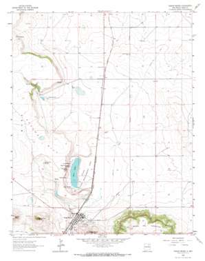
Wagon Mound Topo Map New Mexico
To zoom in, hover over the map of Wagon Mound
USGS Topo Quad 36104a6 - 1:24,000 scale
| Topo Map Name: | Wagon Mound |
| USGS Topo Quad ID: | 36104a6 |
| Print Size: | ca. 21 1/4" wide x 27" high |
| Southeast Coordinates: | 36° N latitude / 104.625° W longitude |
| Map Center Coordinates: | 36.0625° N latitude / 104.6875° W longitude |
| U.S. State: | NM |
| Filename: | o36104a6.jpg |
| Download Map JPG Image: | Wagon Mound topo map 1:24,000 scale |
| Map Type: | Topographic |
| Topo Series: | 7.5´ |
| Map Scale: | 1:24,000 |
| Source of Map Images: | United States Geological Survey (USGS) |
| Alternate Map Versions: |
Wagon Mound NM 1964, updated 1966 Download PDF Buy paper map Wagon Mound NM 2010 Download PDF Buy paper map Wagon Mound NM 2013 Download PDF Buy paper map Wagon Mound NM 2017 Download PDF Buy paper map |
1:24,000 Topo Quads surrounding Wagon Mound
> Back to 36104a1 at 1:100,000 scale
> Back to 36104a1 at 1:250,000 scale
> Back to U.S. Topo Maps home
Wagon Mound topo map: Gazetteer
Wagon Mound: Airports
S and S Ranch Airport elevation 1920m 6299′Wagon Mound: Dams
Berlier Reservoir A Dam elevation 1919m 6295′Wagon Mound: Lakes
Salt Lake elevation 1875m 6151′Wagon Mound: Parks
Wagon Mound Historical Marker elevation 1890m 6200′Wagon Mound: Populated Places
Levy elevation 1911m 6269′Wagon Mound elevation 1890m 6200′
Wagon Mound: Post Offices
Levy Post Office (historical) elevation 1911m 6269′Wagon Mound Post Office elevation 1890m 6200′
Wagon Mound: Reservoirs
Berlier Reservoir elevation 1919m 6295′Wagon Mound: Ridges
Apache Hill elevation 1955m 6414′Wagon Mound: Springs
Big Spring elevation 1896m 6220′Big Willow Spring elevation 1894m 6213′
Coral Spring elevation 1896m 6220′
Correo Spring elevation 1997m 6551′
Dead Cottonwood Spring elevation 1901m 6236′
Santa Clara Springs elevation 1938m 6358′
South Spring elevation 1885m 6184′
Wagon Mound: Streams
Arroyo Puerto elevation 1954m 6410′Wagon Mound: Summits
Las Mesas Del Conjelon elevation 2131m 6991′Santa Clara Mesa elevation 2111m 6925′
The Wagon Mound elevation 2102m 6896′
Wagon Mound: Valleys
Apache Canyon elevation 1932m 6338′Wagon Mound digital topo map on disk
Buy this Wagon Mound topo map showing relief, roads, GPS coordinates and other geographical features, as a high-resolution digital map file on DVD:


