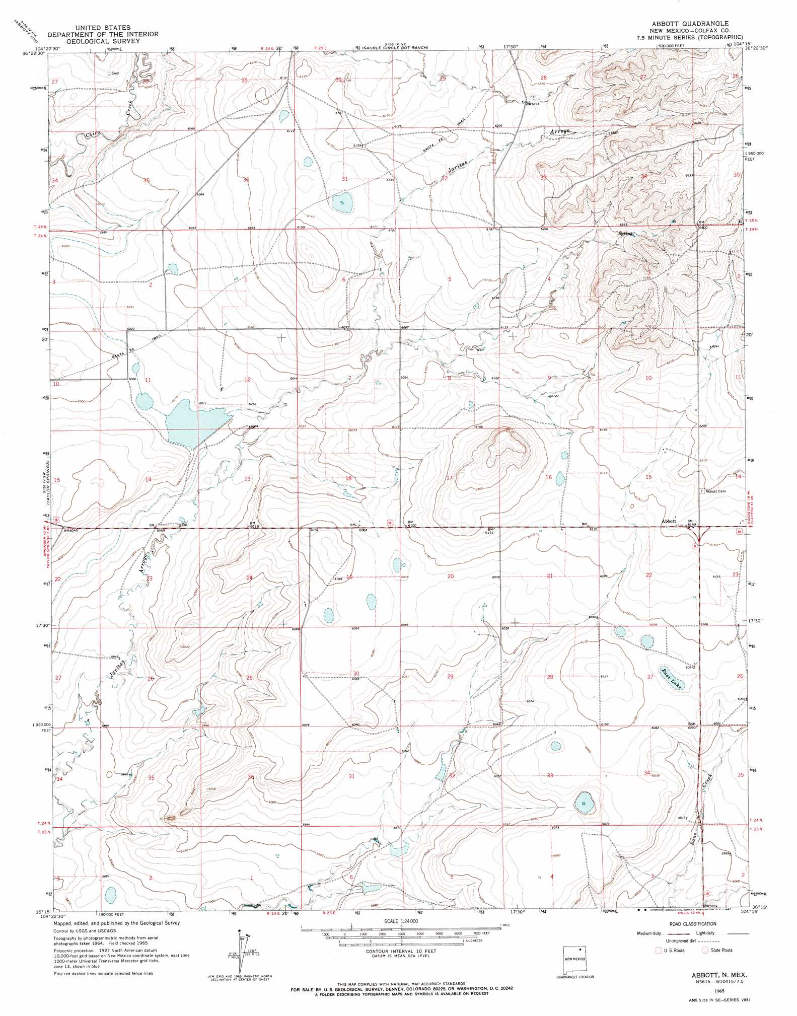
Abbott Topo Map New Mexico
To zoom in, hover over the map of Abbott
USGS Topo Quad 36104c3 - 1:24,000 scale
| Topo Map Name: | Abbott |
| USGS Topo Quad ID: | 36104c3 |
| Print Size: | ca. 21 1/4" wide x 27" high |
| Southeast Coordinates: | 36.25° N latitude / 104.25° W longitude |
| Map Center Coordinates: | 36.3125° N latitude / 104.3125° W longitude |
| U.S. State: | NM |
| Filename: | o36104c3.jpg |
| Download Map JPG Image: | Abbott topo map 1:24,000 scale |
| Map Type: | Topographic |
| Topo Series: | 7.5´ |
| Map Scale: | 1:24,000 |
| Source of Map Images: | United States Geological Survey (USGS) |
| Alternate Map Versions: |
Abbott NM 1965, updated 1967 Download PDF Buy paper map Abbott NM 1998, updated 2001 Download PDF Buy paper map Abbott NM 2010 Download PDF Buy paper map Abbott NM 2013 Download PDF Buy paper map Abbott NM 2017 Download PDF Buy paper map |
1:24,000 Topo Quads surrounding Abbott
Maxwell |
Loco Arroyo |
Tres Hermanos Peak |
Pine Buttes |
Palo Blanco Mountain |
French |
Abbott Nw |
Sauble Circle Dot Ranch |
Point Of Rocks Mesa |
Lawrence Arroyo |
Springer |
Taylor Springs |
Abbott |
Ingram Lake |
Farley |
Stony Lake |
Jaritas Ranch |
Abbott Lake |
Spear Hills |
Divine Lake |
Alto De Hormiga |
Canon Colorado |
Mills West |
Mills East |
Kansas Valley |
> Back to 36104a1 at 1:100,000 scale
> Back to 36104a1 at 1:250,000 scale
> Back to U.S. Topo Maps home
Abbott topo map: Gazetteer
Abbott: Dams
Jaritas Number Two Dam elevation 1831m 6007′Abbott: Lakes
East Lake elevation 1853m 6079′Abbott: Parks
Santa Fe Trail Historical Marker elevation 1840m 6036′Abbott: Populated Places
Abbott elevation 1879m 6164′Abbott: Reservoirs
Big Lake elevation 1831m 6007′Abbott: Trails
Santa fe Trail elevation 1840m 6036′Abbott digital topo map on disk
Buy this Abbott topo map showing relief, roads, GPS coordinates and other geographical features, as a high-resolution digital map file on DVD: