Taylor Springs Topo Map New Mexico
To zoom in, hover over the map of Taylor Springs
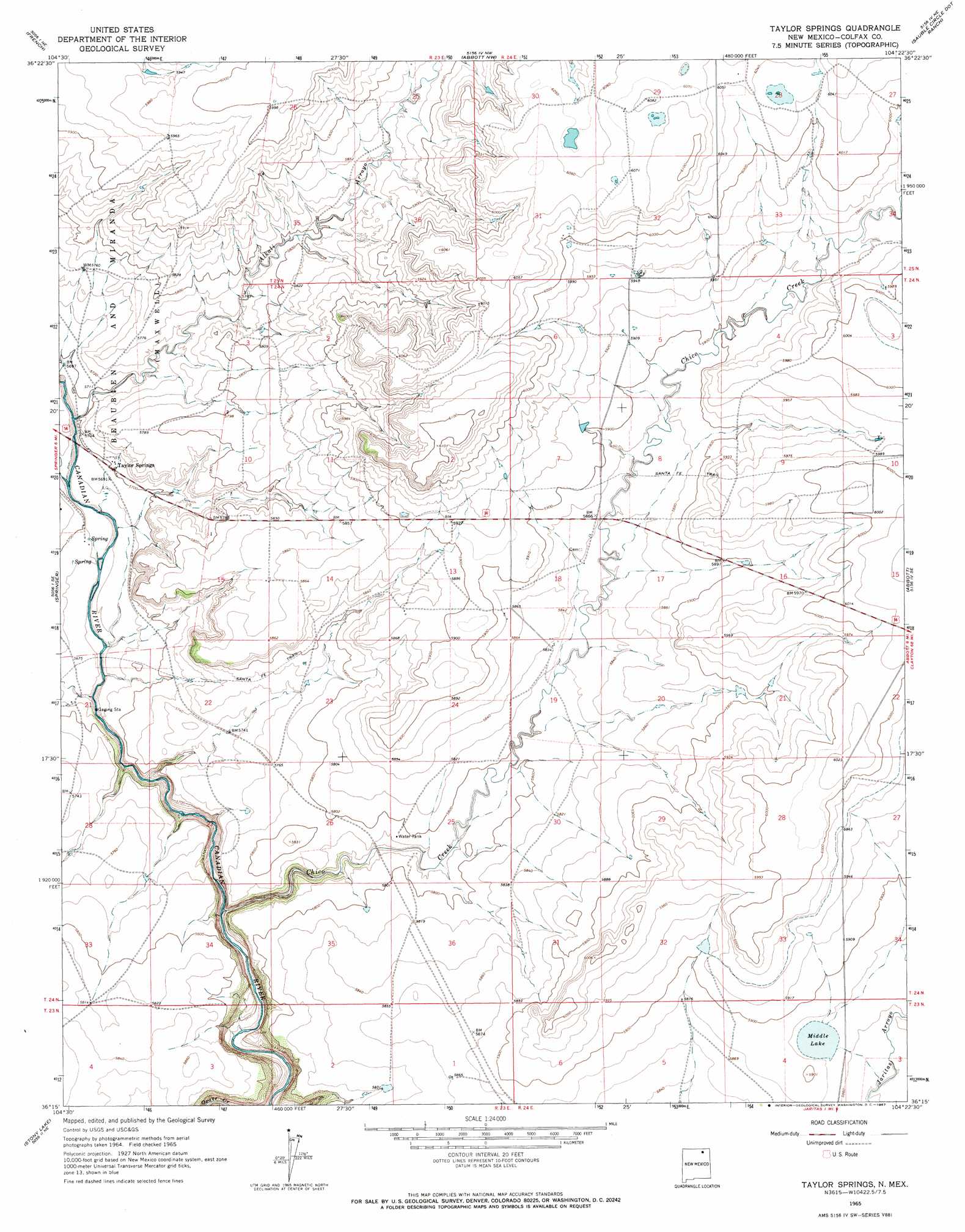
USGS Topo Quad 36104c4 - 1:24,000 scale
| Topo Map Name: | Taylor Springs |
| USGS Topo Quad ID: | 36104c4 |
| Print Size: | ca. 21 1/4" wide x 27" high |
| Southeast Coordinates: | 36.25° N latitude / 104.375° W longitude |
| Map Center Coordinates: | 36.3125° N latitude / 104.4375° W longitude |
| U.S. State: | NM |
| Filename: | o36104c4.jpg |
| Download Map JPG Image: | Taylor Springs topo map 1:24,000 scale |
| Map Type: | Topographic |
| Topo Series: | 7.5´ |
| Map Scale: | 1:24,000 |
| Source of Map Images: | United States Geological Survey (USGS) |
| Alternate Map Versions: |
Taylor Springs NM 1965, updated 1967 Download PDF Buy paper map Taylor Springs NM 2010 Download PDF Buy paper map Taylor Springs NM 2013 Download PDF Buy paper map Taylor Springs NM 2017 Download PDF Buy paper map |
1:24,000 Topo Quads surrounding Taylor Springs
Colfax |
Maxwell |
Loco Arroyo |
Tres Hermanos Peak |
Pine Buttes |
Springer Lake |
French |
Abbott Nw |
Sauble Circle Dot Ranch |
Point Of Rocks Mesa |
Pinon Hills |
Springer |
Taylor Springs |
Abbott |
Ingram Lake |
Colmor |
Stony Lake |
Jaritas Ranch |
Abbott Lake |
Spear Hills |
Wagon Mound |
Alto De Hormiga |
Canon Colorado |
Mills West |
Mills East |
> Back to 36104a1 at 1:100,000 scale
> Back to 36104a1 at 1:250,000 scale
> Back to U.S. Topo Maps home
Taylor Springs topo map: Gazetteer
Taylor Springs: Lakes
Middle Lake elevation 1791m 5875′Taylor Springs: Populated Places
Taylor Springs elevation 1740m 5708′Taylor Springs: Post Offices
Taylor Springs Post Office (historical) elevation 1737m 5698′Taylor Springs: Streams
Alkali Arroyo elevation 1732m 5682′Chico Creek elevation 1705m 5593′
Cimarron River elevation 1731m 5679′
Taylor Springs digital topo map on disk
Buy this Taylor Springs topo map showing relief, roads, GPS coordinates and other geographical features, as a high-resolution digital map file on DVD: