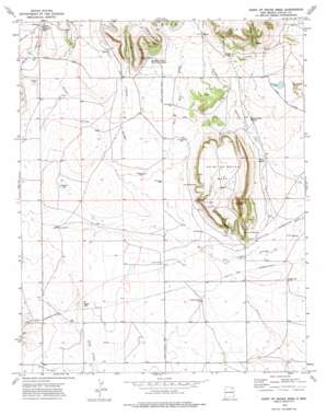
Point Of Rocks Mesa Topo Map New Mexico
To zoom in, hover over the map of Point Of Rocks Mesa
USGS Topo Quad 36104d2 - 1:24,000 scale
| Topo Map Name: | Point Of Rocks Mesa |
| USGS Topo Quad ID: | 36104d2 |
| Print Size: | ca. 21 1/4" wide x 27" high |
| Southeast Coordinates: | 36.375° N latitude / 104.125° W longitude |
| Map Center Coordinates: | 36.4375° N latitude / 104.1875° W longitude |
| U.S. State: | NM |
| Filename: | o36104d2.jpg |
| Download Map JPG Image: | Point Of Rocks Mesa topo map 1:24,000 scale |
| Map Type: | Topographic |
| Topo Series: | 7.5´ |
| Map Scale: | 1:24,000 |
| Source of Map Images: | United States Geological Survey (USGS) |
| Alternate Map Versions: |
Point Of Rocks Mesa NM 1974, updated 1977 Download PDF Buy paper map Point of Rocks Mesa NM 2010 Download PDF Buy paper map Point of Rocks Mesa NM 2013 Download PDF Buy paper map Point of Rocks Mesa NM 2017 Download PDF Buy paper map |
1:24,000 Topo Quads surrounding Point Of Rocks Mesa
> Back to 36104a1 at 1:100,000 scale
> Back to 36104a1 at 1:250,000 scale
> Back to U.S. Topo Maps home
Point Of Rocks Mesa topo map: Gazetteer
Point Of Rocks Mesa: Lakes
Mexican Lake elevation 2029m 6656′Seward Lake elevation 1991m 6532′
Point Of Rocks Mesa: Parks
Dorsey Mansion State Monument elevation 2058m 6751′Point of Rocks Historical Marker elevation 2014m 6607′
View of the Rocks Historical Marker elevation 2014m 6607′
Willow Springs Historical Marker elevation 1968m 6456′
Point Of Rocks Mesa: Populated Places
Chico elevation 2059m 6755′Point Of Rocks Mesa: Post Offices
Chico Post Office (historical) elevation 2059m 6755′Willow Springs Post Office elevation 1968m 6456′
Point Of Rocks Mesa: Springs
Chico Springs elevation 2069m 6788′Middle Water Springs elevation 1994m 6541′
Willow Springs elevation 1968m 6456′
Point Of Rocks Mesa: Streams
Joe Cabin Arroyo elevation 1927m 6322′Rocky Arroyo elevation 1984m 6509′
West Hills Arroyo elevation 1959m 6427′
Point Of Rocks Mesa: Summits
Black Hill elevation 1995m 6545′Hogback Butte elevation 2108m 6916′
Point of Rocks elevation 2014m 6607′
Point of Rocks Mesa elevation 2113m 6932′
Point Of Rocks Mesa: Trails
Santa Fe Trail elevation 1945m 6381′Point Of Rocks Mesa: Valleys
Blackjack Canyon elevation 1979m 6492′Goldmine Canyon elevation 1968m 6456′
Pipeline Canyon elevation 2079m 6820′
Spring Canyon elevation 2069m 6788′
Strong Canyon elevation 1931m 6335′
Youngblood Canyon elevation 1960m 6430′
Point Of Rocks Mesa: Wells
Coulter Well elevation 1971m 6466′Jones Well elevation 1955m 6414′
McBride Well elevation 1984m 6509′
Middle Well elevation 1982m 6502′
Pacheco Well elevation 1995m 6545′
Petty Well elevation 1976m 6482′
Rector Well elevation 1937m 6354′
Wheatland Well elevation 1948m 6391′
Point Of Rocks Mesa digital topo map on disk
Buy this Point Of Rocks Mesa topo map showing relief, roads, GPS coordinates and other geographical features, as a high-resolution digital map file on DVD:


