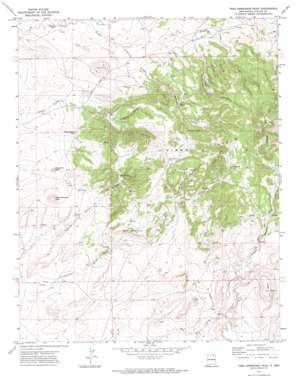
Tres Hermanos Peak Topo Map New Mexico
To zoom in, hover over the map of Tres Hermanos Peak
USGS Topo Quad 36104e3 - 1:24,000 scale
| Topo Map Name: | Tres Hermanos Peak |
| USGS Topo Quad ID: | 36104e3 |
| Print Size: | ca. 21 1/4" wide x 27" high |
| Southeast Coordinates: | 36.5° N latitude / 104.25° W longitude |
| Map Center Coordinates: | 36.5625° N latitude / 104.3125° W longitude |
| U.S. State: | NM |
| Filename: | o36104e3.jpg |
| Download Map JPG Image: | Tres Hermanos Peak topo map 1:24,000 scale |
| Map Type: | Topographic |
| Topo Series: | 7.5´ |
| Map Scale: | 1:24,000 |
| Source of Map Images: | United States Geological Survey (USGS) |
| Alternate Map Versions: |
Tres Hermanos Peak NM 1971, updated 1974 Download PDF Buy paper map Tres Hermanos Peak NM 2010 Download PDF Buy paper map Tres Hermanos Peak NM 2013 Download PDF Buy paper map Tres Hermanos Peak NM 2017 Download PDF Buy paper map |
1:24,000 Topo Quads surrounding Tres Hermanos Peak
> Back to 36104e1 at 1:100,000 scale
> Back to 36104a1 at 1:250,000 scale
> Back to U.S. Topo Maps home
Tres Hermanos Peak topo map: Gazetteer
Tres Hermanos Peak: Mines
Neill 3 Sauble elevation 1905m 6250′Shell Prospect elevation 2074m 6804′
York 1 Tex-Mex elevation 1914m 6279′
Tres Hermanos Peak: Ridges
Three Sisters elevation 2277m 7470′Tres Hermanos Peak: Springs
Alamo Spring elevation 1991m 6532′Allen Spring elevation 2174m 7132′
Notch-in-the-Rock Spring elevation 2024m 6640′
Rock Spring elevation 2060m 6758′
Shoemaker Spring elevation 2103m 6899′
Tres Hermanos Peak: Streams
Archuleta Arroyo elevation 1979m 6492′Granny Creek elevation 1958m 6423′
Tres Hermanos Peak: Summits
Cerrito Gato elevation 1960m 6430′Cerro Ermitano elevation 2198m 7211′
Fudge Hill elevation 2202m 7224′
Margarito Peak elevation 2010m 6594′
Piñon Hills elevation 2147m 7043′
Shoemaker Hill elevation 2014m 6607′
Tres Hermanos Peak elevation 2062m 6765′
Turkey Mountain elevation 2401m 7877′
Tres Hermanos Peak: Valleys
Allen Canyon elevation 2099m 6886′Chiflones Canyon elevation 2013m 6604′
Road Canyon elevation 2037m 6683′
Screw Plate Canyon elevation 2083m 6833′
Slagel Canyon elevation 1997m 6551′
Tecolote Canyon elevation 1947m 6387′
Van Bruggen Canyon elevation 2004m 6574′
Tres Hermanos Peak digital topo map on disk
Buy this Tres Hermanos Peak topo map showing relief, roads, GPS coordinates and other geographical features, as a high-resolution digital map file on DVD:


