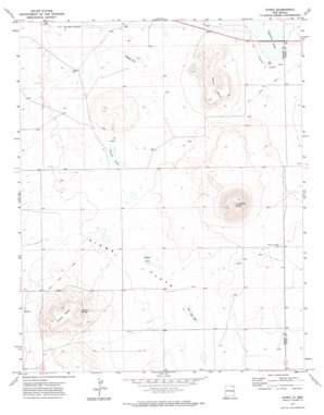
Kiowa Topo Map New Mexico
To zoom in, hover over the map of Kiowa
USGS Topo Quad 36104f1 - 1:24,000 scale
| Topo Map Name: | Kiowa |
| USGS Topo Quad ID: | 36104f1 |
| Print Size: | ca. 21 1/4" wide x 27" high |
| Southeast Coordinates: | 36.625° N latitude / 104° W longitude |
| Map Center Coordinates: | 36.6875° N latitude / 104.0625° W longitude |
| U.S. State: | NM |
| Filename: | o36104f1.jpg |
| Download Map JPG Image: | Kiowa topo map 1:24,000 scale |
| Map Type: | Topographic |
| Topo Series: | 7.5´ |
| Map Scale: | 1:24,000 |
| Source of Map Images: | United States Geological Survey (USGS) |
| Alternate Map Versions: |
Kiowa NM 1971, updated 1974 Download PDF Buy paper map Kiowa NM 2010 Download PDF Buy paper map Kiowa NM 2013 Download PDF Buy paper map Kiowa NM 2017 Download PDF Buy paper map |
1:24,000 Topo Quads surrounding Kiowa
> Back to 36104e1 at 1:100,000 scale
> Back to 36104a1 at 1:250,000 scale
> Back to U.S. Topo Maps home
Kiowa topo map: Gazetteer
Kiowa: Craters
Horseshoe Crater elevation 2262m 7421′Kiowa: Flats
Kiowa Flats elevation 2098m 6883′Kiowa: Lakes
Capulin Lake elevation 2074m 6804′Cassan Lake elevation 2076m 6811′
Farr Vega Lake elevation 2079m 6820′
Lakeside Lake elevation 2079m 6820′
Widow Lake elevation 2082m 6830′
Kiowa: Mines
Horse Shoe Crater elevation 2168m 7112′Kiowa: Populated Places
Kiowa elevation 2164m 7099′Kiowa: Post Offices
Kiowa Post Office (historical) elevation 2164m 7099′Kiowa: Springs
Kiowa Springs elevation 2170m 7119′Kiowa: Streams
Chacon Arroyo elevation 2079m 6820′Kiowa: Summits
Kiowa Mesa elevation 2287m 7503′Melon Mesa elevation 2197m 7208′
Kiowa: Trails
Fort Union Road elevation 2117m 6945′Kiowa: Wells
10005 Water Well elevation 2079m 6820′10006 Water Well elevation 2083m 6833′
Kiowa digital topo map on disk
Buy this Kiowa topo map showing relief, roads, GPS coordinates and other geographical features, as a high-resolution digital map file on DVD:


