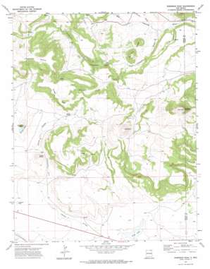
Robinson Peak Topo Map New Mexico
To zoom in, hover over the map of Robinson Peak
USGS Topo Quad 36104g1 - 1:24,000 scale
| Topo Map Name: | Robinson Peak |
| USGS Topo Quad ID: | 36104g1 |
| Print Size: | ca. 21 1/4" wide x 27" high |
| Southeast Coordinates: | 36.75° N latitude / 104° W longitude |
| Map Center Coordinates: | 36.8125° N latitude / 104.0625° W longitude |
| U.S. State: | NM |
| Filename: | o36104g1.jpg |
| Download Map JPG Image: | Robinson Peak topo map 1:24,000 scale |
| Map Type: | Topographic |
| Topo Series: | 7.5´ |
| Map Scale: | 1:24,000 |
| Source of Map Images: | United States Geological Survey (USGS) |
| Alternate Map Versions: |
Robinson Peak NM 1971, updated 1974 Download PDF Buy paper map Robinson Peak NM 2010 Download PDF Buy paper map Robinson Peak NM 2013 Download PDF Buy paper map Robinson Peak NM 2017 Download PDF Buy paper map |
1:24,000 Topo Quads surrounding Robinson Peak
> Back to 36104e1 at 1:100,000 scale
> Back to 36104a1 at 1:250,000 scale
> Back to U.S. Topo Maps home
Robinson Peak topo map: Gazetteer
Robinson Peak: Lakes
Gringo Lake elevation 2156m 7073′King Lake elevation 2070m 6791′
Rockwell Lake elevation 2110m 6922′
Robinson Peak: Mines
Cinder Butte elevation 2166m 7106′Jose Butte elevation 2338m 7670′
Robinson Peak: Springs
Griego Spring elevation 2220m 7283′Robinson Peak: Streams
Archuleta Creek elevation 2033m 6669′Cherry Creek elevation 2042m 6699′
Wild Horse Arroyo elevation 2073m 6801′
Robinson Peak: Summits
Cinder Butte elevation 2240m 7349′Griego Mesa elevation 2361m 7746′
Gringo Peak elevation 2225m 7299′
Jose Butte elevation 2471m 8106′
Robinson Peak elevation 2452m 8044′
Twin Buttes elevation 2178m 7145′
Robinson Peak: Valleys
Jack Miller Canyon elevation 2039m 6689′Martinez Canyon elevation 2093m 6866′
Prudencio Canyon elevation 2094m 6870′
Rattlesnake Draw elevation 2122m 6961′
Robinson Peak: Wells
10000 Water Well elevation 2078m 6817′10001 Water Well elevation 2079m 6820′
10007 Water Well elevation 2099m 6886′
Robinson Peak digital topo map on disk
Buy this Robinson Peak topo map showing relief, roads, GPS coordinates and other geographical features, as a high-resolution digital map file on DVD:


