Tin Pan Canyon Topo Map New Mexico
To zoom in, hover over the map of Tin Pan Canyon
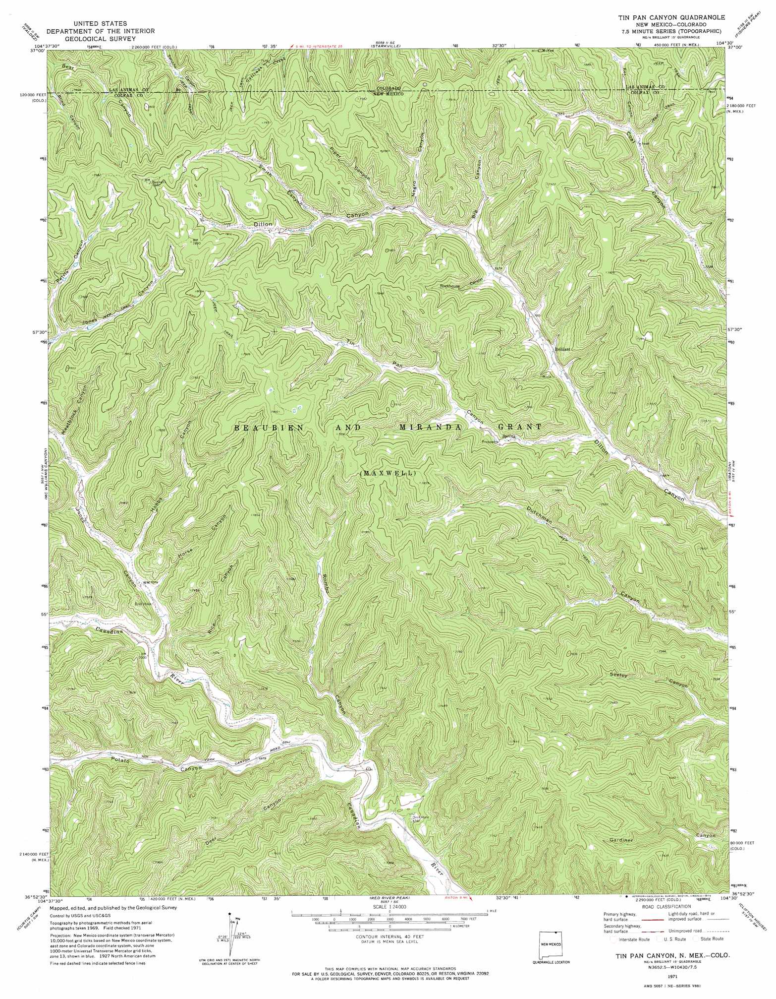
USGS Topo Quad 36104h5 - 1:24,000 scale
| Topo Map Name: | Tin Pan Canyon |
| USGS Topo Quad ID: | 36104h5 |
| Print Size: | ca. 21 1/4" wide x 27" high |
| Southeast Coordinates: | 36.875° N latitude / 104.5° W longitude |
| Map Center Coordinates: | 36.9375° N latitude / 104.5625° W longitude |
| U.S. States: | NM, CO |
| Filename: | o36104h5.jpg |
| Download Map JPG Image: | Tin Pan Canyon topo map 1:24,000 scale |
| Map Type: | Topographic |
| Topo Series: | 7.5´ |
| Map Scale: | 1:24,000 |
| Source of Map Images: | United States Geological Survey (USGS) |
| Alternate Map Versions: |
Tin Pan Canyon NM 1971, updated 1974 Download PDF Buy paper map Tin Pan Canyon NM 2010 Download PDF Buy paper map Tin Pan Canyon NM 2013 Download PDF Buy paper map Tin Pan Canyon NM 2017 Download PDF Buy paper map |
1:24,000 Topo Quads surrounding Tin Pan Canyon
Weston |
Madrid |
Trinidad West |
Trinidad East |
Mooney Hills |
Little Pine Canyon |
Valdez |
Starkville |
Fishers Peak |
Barela |
Caliente Canyon North |
Mcwilliams Canyon |
Tin Pan Canyon |
Raton |
Yankee |
Caliente Canyon South |
Curtis Camp |
Red River Peak |
Clifton House |
Hunter Mesa |
Dawson |
Saltpeter Mountain |
Koehler |
Eagle Tail Mountain |
Tinaja Mountain |
> Back to 36104e1 at 1:100,000 scale
> Back to 36104a1 at 1:250,000 scale
> Back to U.S. Topo Maps home
Tin Pan Canyon topo map: Gazetteer
Tin Pan Canyon: Mines
Bartlett Mine elevation 2174m 7132′Blossburg Number Four elevation 2258m 7408′
Brilliant Coal Mine elevation 2212m 7257′
Dutchman Coal Mine elevation 2127m 6978′
Tin Pan Canyon: Populated Places
Brilliant elevation 2184m 7165′Tin Pan Canyon: Post Offices
Brilliant Post Office (historical) elevation 2184m 7165′Tin Pan Canyon: Valleys
Big Canyon elevation 2231m 7319′Big Canyon elevation 2230m 7316′
Blind Canyon elevation 2221m 7286′
Blind Canyon elevation 2222m 7290′
Deer Canyon elevation 2083m 6833′
Hobbs Canyon elevation 2164m 7099′
Horse Canyon elevation 2131m 6991′
Meatblock Canyon elevation 2214m 7263′
Negro Canyon elevation 2250m 7381′
Negro Canyon elevation 2251m 7385′
Pertie Canyon elevation 2265m 7431′
Piper Canyon elevation 2269m 7444′
Potato Canyon elevation 2089m 6853′
Rex Canyon elevation 2284m 7493′
Rex Canyon elevation 2275m 7463′
Rice Canyon elevation 2120m 6955′
Rockhouse Canyon elevation 2217m 7273′
Rombo Canyon elevation 2075m 6807′
Smith Canyon elevation 2297m 7536′
Tin Pan Canyon elevation 2148m 7047′
Tin Pan Canyon digital topo map on disk
Buy this Tin Pan Canyon topo map showing relief, roads, GPS coordinates and other geographical features, as a high-resolution digital map file on DVD: