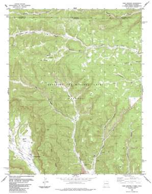
Casa Grande Topo Map New Mexico
To zoom in, hover over the map of Casa Grande
USGS Topo Quad 36104h8 - 1:24,000 scale
| Topo Map Name: | Casa Grande |
| USGS Topo Quad ID: | 36104h8 |
| Print Size: | ca. 21 1/4" wide x 27" high |
| Southeast Coordinates: | 36.875° N latitude / 104.875° W longitude |
| Map Center Coordinates: | 36.9375° N latitude / 104.9375° W longitude |
| U.S. States: | NM, CO |
| Filename: | o36104h8.jpg |
| Download Map JPG Image: | Casa Grande topo map 1:24,000 scale |
| Map Type: | Topographic |
| Topo Series: | 7.5´ |
| Map Scale: | 1:24,000 |
| Source of Map Images: | United States Geological Survey (USGS) |
| Alternate Map Versions: |
Casa Grande NM 1986, updated 1986 Download PDF Buy paper map Casa Grande NM 2010 Download PDF Buy paper map Casa Grande NM 2013 Download PDF Buy paper map |
1:24,000 Topo Quads surrounding Casa Grande
> Back to 36104e1 at 1:100,000 scale
> Back to 36104a1 at 1:250,000 scale
> Back to U.S. Topo Maps home
Casa Grande topo map: Gazetteer
Casa Grande: Flats
Butler Flats elevation 2298m 7539′Vermejo Park elevation 2283m 7490′
Casa Grande: Mines
Kaiser Plant elevation 2292m 7519′Kaiser Steel elevation 2339m 7673′
West York Canyon elevation 2357m 7732′
West York Strip elevation 2320m 7611′
York Canyon Number 1 elevation 2485m 8152′
York Canyon Prospect elevation 2578m 8458′
Casa Grande: Populated Places
Casa Grande elevation 2297m 7536′Casa Grande: Post Offices
Casa Grande Post Office (historical) elevation 2297m 7536′Casa Grande: Streams
Patton Creek elevation 2511m 8238′Casa Grande: Valleys
Holly Canyon elevation 2343m 7687′Left Fork York Canyon elevation 2353m 7719′
Patten Canyon elevation 2511m 8238′
Right Fork York Canyon elevation 2353m 7719′
Spring Canyon elevation 2290m 7513′
Casa Grande digital topo map on disk
Buy this Casa Grande topo map showing relief, roads, GPS coordinates and other geographical features, as a high-resolution digital map file on DVD:


