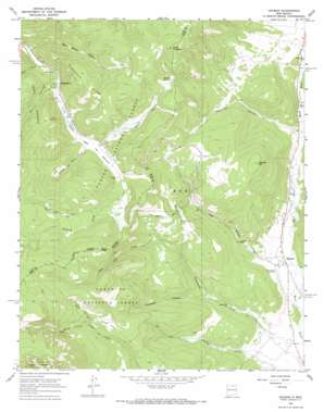
Holman Topo Map New Mexico
To zoom in, hover over the map of Holman
USGS Topo Quad 36105a4 - 1:24,000 scale
| Topo Map Name: | Holman |
| USGS Topo Quad ID: | 36105a4 |
| Print Size: | ca. 21 1/4" wide x 27" high |
| Southeast Coordinates: | 36° N latitude / 105.375° W longitude |
| Map Center Coordinates: | 36.0625° N latitude / 105.4375° W longitude |
| U.S. State: | NM |
| Filename: | o36105a4.jpg |
| Download Map JPG Image: | Holman topo map 1:24,000 scale |
| Map Type: | Topographic |
| Topo Series: | 7.5´ |
| Map Scale: | 1:24,000 |
| Source of Map Images: | United States Geological Survey (USGS) |
| Alternate Map Versions: |
Holman NM 1965, updated 1968 Download PDF Buy paper map Holman NM 1995, updated 1998 Download PDF Buy paper map Holman NM 2011 Download PDF Buy paper map Holman NM 2013 Download PDF Buy paper map |
| FStopo: | US Forest Service topo Holman is available: Download FStopo PDF Download FStopo TIF |
1:24,000 Topo Quads surrounding Holman
> Back to 36105a1 at 1:100,000 scale
> Back to 36104a1 at 1:250,000 scale
> Back to U.S. Topo Maps home
Holman topo map: Gazetteer
Holman: Areas
Vega del Estillero elevation 2777m 9110′Holman: Canals
La Sierra Ditch elevation 2531m 8303′Holman: Flats
Walker Flats elevation 2802m 9192′Holman: Lakes
Las Lagunas elevation 2706m 8877′Holman: Mines
Limestone Quarry elevation 2825m 9268′Holman: Populated Places
Angostura elevation 2738m 8982′Angostura elevation 2737m 8979′
Holman elevation 2305m 7562′
Holman: Post Offices
Agua Negra Post Office (historical) elevation 2325m 7627′Holman Post Office elevation 2305m 7562′
Holman: Ridges
Angostura Ridge elevation 3046m 9993′Holman: Springs
Loring Spring elevation 2897m 9504′Holman: Streams
Agua Fria Creek elevation 2505m 8218′Alamitos Creek elevation 2772m 9094′
Cañada de Don Samuel elevation 2752m 9028′
Cañoncito Creek elevation 2261m 7417′
Knob Creek elevation 2674m 8772′
La Canada de los Maes elevation 2270m 7447′
Rito Angostura elevation 2698m 8851′
Holman: Summits
Cerro Picacho elevation 3136m 10288′Holman Hill elevation 2831m 9288′
Holman: Valleys
Agua Sarca Canyon elevation 2664m 8740′Alamitos Canyon elevation 2364m 7755′
Corrales Canyon elevation 2387m 7831′
Osha Canyon elevation 2811m 9222′
Raton Canyon elevation 2776m 9107′
Vigil Canyon elevation 2327m 7634′
Holman digital topo map on disk
Buy this Holman topo map showing relief, roads, GPS coordinates and other geographical features, as a high-resolution digital map file on DVD:


