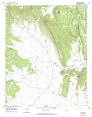
Ocate Topo Map New Mexico
To zoom in, hover over the map of Ocate
USGS Topo Quad 36105b1 - 1:24,000 scale
| Topo Map Name: | Ocate |
| USGS Topo Quad ID: | 36105b1 |
| Print Size: | ca. 21 1/4" wide x 27" high |
| Southeast Coordinates: | 36.125° N latitude / 105° W longitude |
| Map Center Coordinates: | 36.1875° N latitude / 105.0625° W longitude |
| U.S. State: | NM |
| Filename: | o36105b1.jpg |
| Download Map JPG Image: | Ocate topo map 1:24,000 scale |
| Map Type: | Topographic |
| Topo Series: | 7.5´ |
| Map Scale: | 1:24,000 |
| Source of Map Images: | United States Geological Survey (USGS) |
| Alternate Map Versions: |
Ocate NM 1966, updated 1968 Download PDF Buy paper map Ocate NM 1966, updated 1974 Download PDF Buy paper map Ocate NM 1994, updated 1998 Download PDF Buy paper map Ocate NM 2010 Download PDF Buy paper map Ocate NM 2013 Download PDF Buy paper map |
1:24,000 Topo Quads surrounding Ocate
> Back to 36105a1 at 1:100,000 scale
> Back to 36104a1 at 1:250,000 scale
> Back to U.S. Topo Maps home
Ocate topo map: Gazetteer
Ocate: Mines
Laizy Daisy elevation 2356m 7729′William Atkens elevation 2288m 7506′
Ocate: Populated Places
Halls Peak (historical) elevation 2308m 7572′Los Huerros elevation 2298m 7539′
Los LeFebres elevation 2321m 7614′
Ocate elevation 2197m 7208′
Ocate: Post Offices
Ocate Post Office elevation 2197m 7208′Ocate: Ridges
Cejita elevation 2346m 7696′Ocate: Streams
Banderitas Creek elevation 2164m 7099′La Canada elevation 2192m 7191′
LeFebres Creek elevation 2183m 7162′
Los Huerros Creek elevation 2190m 7185′
Manueles Creek elevation 2254m 7395′
Wheaten Creek elevation 2255m 7398′
Ocate: Summits
Cerrito Pelon elevation 2461m 8074′Cooks Peak elevation 2618m 8589′
Gallinas Mesa elevation 2558m 8392′
Halls Peak elevation 2651m 8697′
Los Naranjos Peak elevation 2461m 8074′
Ocate Peak elevation 2377m 7798′
Ocate: Valleys
Chavez Canyon elevation 2165m 7103′Franklin Canyon elevation 2323m 7621′
LeFebres Canyon elevation 2309m 7575′
Los Huerros Canyon elevation 2285m 7496′
Manueles Canyon elevation 2350m 7709′
Mares Canyon elevation 2371m 7778′
Martinez Canyon elevation 2364m 7755′
Ocate digital topo map on disk
Buy this Ocate topo map showing relief, roads, GPS coordinates and other geographical features, as a high-resolution digital map file on DVD:


