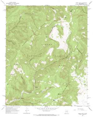
Cerro Vista Topo Map New Mexico
To zoom in, hover over the map of Cerro Vista
USGS Topo Quad 36105b4 - 1:24,000 scale
| Topo Map Name: | Cerro Vista |
| USGS Topo Quad ID: | 36105b4 |
| Print Size: | ca. 21 1/4" wide x 27" high |
| Southeast Coordinates: | 36.125° N latitude / 105.375° W longitude |
| Map Center Coordinates: | 36.1875° N latitude / 105.4375° W longitude |
| U.S. State: | NM |
| Filename: | o36105b4.jpg |
| Download Map JPG Image: | Cerro Vista topo map 1:24,000 scale |
| Map Type: | Topographic |
| Topo Series: | 7.5´ |
| Map Scale: | 1:24,000 |
| Source of Map Images: | United States Geological Survey (USGS) |
| Alternate Map Versions: |
Cerro Vista NM 1965, updated 1969 Download PDF Buy paper map Cerro Vista NM 1995, updated 1997 Download PDF Buy paper map Cerro Vista NM 2011 Download PDF Buy paper map Cerro Vista NM 2013 Download PDF Buy paper map |
| FStopo: | US Forest Service topo Cerro Vista is available: Download FStopo PDF Download FStopo TIF |
1:24,000 Topo Quads surrounding Cerro Vista
> Back to 36105a1 at 1:100,000 scale
> Back to 36104a1 at 1:250,000 scale
> Back to U.S. Topo Maps home
Cerro Vista topo map: Gazetteer
Cerro Vista: Canals
Sierra Ditch elevation 3165m 10383′Cerro Vista: Lakes
Huero Lake elevation 3411m 11190′La Cueva Lake elevation 3095m 10154′
Romero Lake elevation 2983m 9786′
Cerro Vista: Ridges
Cuchillas elevation 3353m 11000′Cerro Vista: Streams
Duran Creek elevation 2669m 8756′Policarpio Creek elevation 2729m 8953′
Cerro Vista: Summits
Cerro del Oso elevation 3431m 11256′Cerro Olla elevation 3643m 11952′
Cerro Vista elevation 3638m 11935′
La Cueva Peak elevation 3251m 10666′
Cerro Vista: Valleys
Arellano Canyon elevation 2700m 8858′Policarpio Canyon elevation 2734m 8969′
Sardinas Canyon elevation 2803m 9196′
Valle De Las Romeros elevation 2926m 9599′
Cerro Vista digital topo map on disk
Buy this Cerro Vista topo map showing relief, roads, GPS coordinates and other geographical features, as a high-resolution digital map file on DVD:


