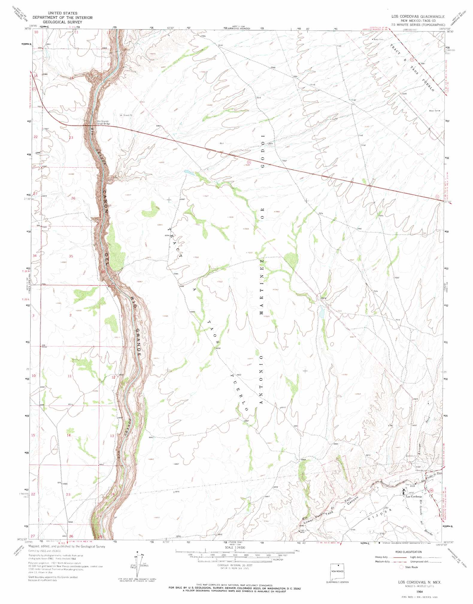
Los Cordovas Topo Map New Mexico
To zoom in, hover over the map of Los Cordovas
USGS Topo Quad 36105d6 - 1:24,000 scale
| Topo Map Name: | Los Cordovas |
| USGS Topo Quad ID: | 36105d6 |
| Print Size: | ca. 21 1/4" wide x 27" high |
| Southeast Coordinates: | 36.375° N latitude / 105.625° W longitude |
| Map Center Coordinates: | 36.4375° N latitude / 105.6875° W longitude |
| U.S. State: | NM |
| Filename: | o36105d6.jpg |
| Download Map JPG Image: | Los Cordovas topo map 1:24,000 scale |
| Map Type: | Topographic |
| Topo Series: | 7.5´ |
| Map Scale: | 1:24,000 |
| Source of Map Images: | United States Geological Survey (USGS) |
| Alternate Map Versions: |
Los Cordovas NM 1964, updated 1966 Download PDF Buy paper map Los Cordovas NM 2010 Download PDF Buy paper map Los Cordovas NM 2013 Download PDF Buy paper map |
1:24,000 Topo Quads surrounding Los Cordovas
Tres Piedras |
Tres Piedras Ne |
Guadalupe Mountain |
Questa |
Red River |
Petaca Peak |
Cerro De Los Taoses |
Arroyo Hondo |
Arroyo Seco |
Wheeler Peak |
Servilleta Plaza |
Tres Orejas |
Los Cordovas |
Taos |
Pueblo Peak |
Taos Junction |
Carson |
Taos Sw |
Ranchos De Taos |
Shady Brook |
Velarde |
Trampas |
Penasco |
Tres Ritos |
Cerro Vista |
> Back to 36105a1 at 1:100,000 scale
> Back to 36104a1 at 1:250,000 scale
> Back to U.S. Topo Maps home
Los Cordovas topo map: Gazetteer
Los Cordovas: Airports
Taos Municipal Airport elevation 2154m 7066′Los Cordovas: Bridges
Rio Grande Gorge Bridge elevation 1950m 6397′Los Cordovas: Mines
Rio Grande Placer District elevation 2114m 6935′Los Cordovas: Parks
Rio Grande Gorge Historical Marker elevation 1950m 6397′Los Cordovas: Populated Places
Los Cordovas elevation 2057m 6748′Los Cordovas: Rapids
Dead Car Rapid elevation 1919m 6295′High Bridge Rapid elevation 2123m 6965′
Power Line Falls Rapid elevation 1964m 6443′
Rock Garden elevation 1904m 6246′
Ski Jump Rapid elevation 1969m 6459′
Yellow Bank Rapid elevation 1941m 6368′
Los Cordovas: Streams
Arroyo Seco elevation 2049m 6722′Rio Grande del Rancho elevation 2049m 6722′
Los Cordovas: Wells
Airport Water Well elevation 2154m 7066′RG-35518 Water Well elevation 2031m 6663′
Rio Gorge Water Well elevation 2123m 6965′
Los Cordovas digital topo map on disk
Buy this Los Cordovas topo map showing relief, roads, GPS coordinates and other geographical features, as a high-resolution digital map file on DVD: