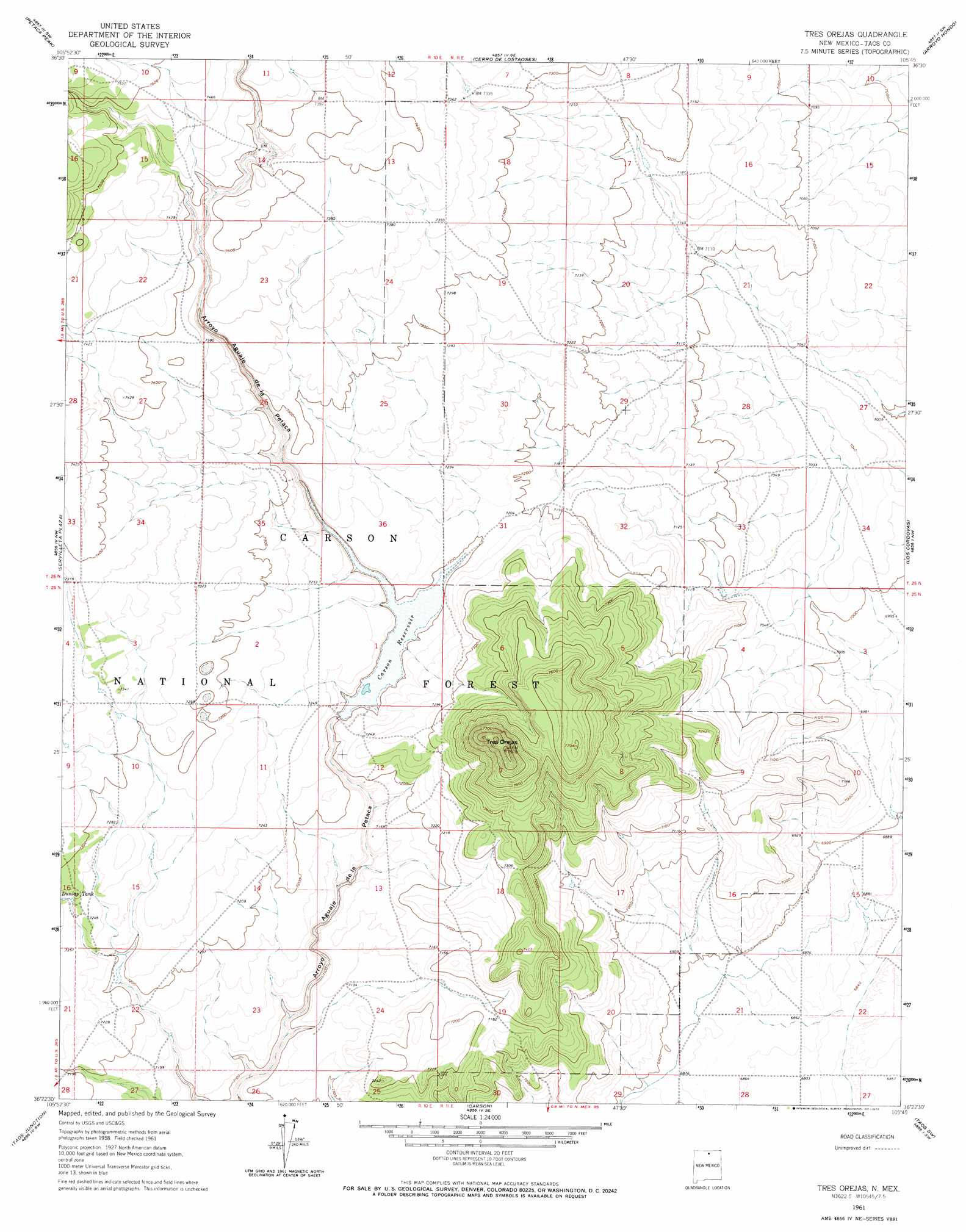
Tres Orejas Topo Map New Mexico
To zoom in, hover over the map of Tres Orejas
USGS Topo Quad 36105d7 - 1:24,000 scale
| Topo Map Name: | Tres Orejas |
| USGS Topo Quad ID: | 36105d7 |
| Print Size: | ca. 21 1/4" wide x 27" high |
| Southeast Coordinates: | 36.375° N latitude / 105.75° W longitude |
| Map Center Coordinates: | 36.4375° N latitude / 105.8125° W longitude |
| U.S. State: | NM |
| Filename: | o36105d7.jpg |
| Download Map JPG Image: | Tres Orejas topo map 1:24,000 scale |
| Map Type: | Topographic |
| Topo Series: | 7.5´ |
| Map Scale: | 1:24,000 |
| Source of Map Images: | United States Geological Survey (USGS) |
| Alternate Map Versions: |
Tres Orejas NM 1961, updated 1963 Download PDF Buy paper map Tres Orejas NM 1961, updated 1972 Download PDF Buy paper map Tres Orejas NM 1995, updated 1998 Download PDF Buy paper map Tres Orejas NM 2011 Download PDF Buy paper map Tres Orejas NM 2013 Download PDF Buy paper map |
| FStopo: | US Forest Service topo Tres Orejas is available: Download FStopo PDF Download FStopo TIF |
1:24,000 Topo Quads surrounding Tres Orejas
Mule Canyon |
Tres Piedras |
Tres Piedras Ne |
Guadalupe Mountain |
Questa |
Las Tablas |
Petaca Peak |
Cerro De Los Taoses |
Arroyo Hondo |
Arroyo Seco |
La Madera |
Servilleta Plaza |
Tres Orejas |
Los Cordovas |
Taos |
Ojo Caliente |
Taos Junction |
Carson |
Taos Sw |
Ranchos De Taos |
Lyden |
Velarde |
Trampas |
Penasco |
Tres Ritos |
> Back to 36105a1 at 1:100,000 scale
> Back to 36104a1 at 1:250,000 scale
> Back to U.S. Topo Maps home
Tres Orejas topo map: Gazetteer
Tres Orejas: Dams
Carson Reservoir Dam elevation 2201m 7221′Tres Orejas: Reservoirs
Borrego Tank elevation 2209m 7247′Carson Reservoir elevation 2201m 7221′
Dunlap Tank elevation 2210m 7250′
Orejas Tank elevation 2161m 7089′
Reveg Tank elevation 2255m 7398′
Rocky Tank elevation 2171m 7122′
Section Fifteen Tank elevation 2261m 7417′
Soloman Tank elevation 2235m 7332′
Stover Tank elevation 2185m 7168′
TCLP Tank elevation 2193m 7194′
Torres Tank elevation 2154m 7066′
Viego Tank elevation 2251m 7385′
Tres Orejas: Summits
Tres Orejas elevation 2422m 7946′Tres Orejas digital topo map on disk
Buy this Tres Orejas topo map showing relief, roads, GPS coordinates and other geographical features, as a high-resolution digital map file on DVD: