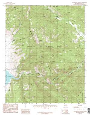
Touch-Me-Not Mountain Topo Map New Mexico
To zoom in, hover over the map of Touch-Me-Not Mountain
USGS Topo Quad 36105e2 - 1:24,000 scale
| Topo Map Name: | Touch-Me-Not Mountain |
| USGS Topo Quad ID: | 36105e2 |
| Print Size: | ca. 21 1/4" wide x 27" high |
| Southeast Coordinates: | 36.5° N latitude / 105.125° W longitude |
| Map Center Coordinates: | 36.5625° N latitude / 105.1875° W longitude |
| U.S. State: | NM |
| Filename: | o36105e2.jpg |
| Download Map JPG Image: | Touch-Me-Not Mountain topo map 1:24,000 scale |
| Map Type: | Topographic |
| Topo Series: | 7.5´ |
| Map Scale: | 1:24,000 |
| Source of Map Images: | United States Geological Survey (USGS) |
| Alternate Map Versions: |
Touch-Me-Not Mountain NM 1987, updated 1987 Download PDF Buy paper map Touch-Me-Not Mountain NM 2010 Download PDF Buy paper map Touch-Me-Not Mountain NM 2013 Download PDF Buy paper map |
1:24,000 Topo Quads surrounding Touch-Me-Not Mountain
> Back to 36105e1 at 1:100,000 scale
> Back to 36104a1 at 1:250,000 scale
> Back to U.S. Topo Maps home
Touch-Me-Not Mountain topo map: Gazetteer
Touch-Me-Not Mountain: Cliffs
Palisades elevation 2377m 7798′Touch-Me-Not Mountain: Dams
Eagle Nest Dam elevation 2613m 8572′Touch-Me-Not Mountain: Lakes
Gravel Pit Lakes elevation 2297m 7536′Lake Aspen elevation 2645m 8677′
Lake Doris elevation 2665m 8743′
Touch-Me-Not Mountain: Mines
Ajax Mine elevation 2961m 9714′Alabama elevation 2698m 8851′
American Flag elevation 2972m 9750′
Aristocrat Mine elevation 3085m 10121′
Arlington Mine elevation 3281m 10764′
Big Mike Mine elevation 3085m 10121′
Black Horse Group elevation 3275m 10744′
Black Tail elevation 3011m 9878′
Bobtail Mine elevation 3008m 9868′
Brilliant Mine elevation 3352m 10997′
Bull of the Woods Mine elevation 3253m 10672′
Cincinnati Mine elevation 3281m 10764′
Eleanor Mine elevation 3355m 11007′
Euclid Mine elevation 3355m 11007′
Faro Banks Mine elevation 3146m 10321′
Florence Mine elevation 3281m 10764′
Gold Dollar elevation 3119m 10232′
Good Fairy Mine elevation 3253m 10672′
Good Friend elevation 3563m 11689′
Grand Duchess Mine elevation 3146m 10321′
Grand View Mine elevation 3352m 10997′
Grand View Number 3 Mine elevation 3352m 10997′
Grey Eagle Number Two Mine elevation 3352m 10997′
Grub Flat Mine elevation 3281m 10764′
Heart of the World Mine elevation 3085m 10121′
Helen Gould elevation 3062m 10045′
Helen Mine elevation 3002m 9849′
Hidden Treasure Mine elevation 3068m 10065′
Horseshoe Mine elevation 2452m 8044′
Independence Number 4 Mine elevation 3281m 10764′
Independence Number 6 Mine elevation 3055m 10022′
Indiana Mine elevation 3281m 10764′
Iron Mask Mine elevation 3008m 9868′
Isabella B Mine elevation 3352m 10997′
J V C Mine elevation 3146m 10321′
Jennings Mine elevation 3002m 9849′
Kensington Mine elevation 3352m 10997′
Legal Tender Mine elevation 3049m 10003′
Lexington Mine elevation 3085m 10121′
Little Wonder Mine elevation 3352m 10997′
Louisville Number 2 Mine elevation 3008m 9868′
Metropole Mine elevation 3146m 10321′
Montezuma Mine elevation 3055m 10022′
Mount Lion Number 2 Mine elevation 3281m 10764′
Mountain Queen Number 1 Mine elevation 3146m 10321′
Mountain Queen Number 2 Mine elevation 3146m 10321′
Mountain View Number 1 Mine elevation 3126m 10255′
Nancy Hanks Number 2 Mine elevation 3146m 10321′
New Mexican Mine elevation 3085m 10121′
North Star Mine elevation 3085m 10121′
Onion Mine elevation 3352m 10997′
Only Chance Mine elevation 3126m 10255′
Ophia Mine elevation 3281m 10764′
Paragon Claim elevation 3470m 11384′
Pay Mine elevation 3061m 10042′
Pink Cheek elevation 3098m 10164′
Real Mine elevation 3055m 10022′
Rebel Chief Mine elevation 2969m 9740′
Rebel Chief Placer elevation 2813m 9229′
Royal Flush Mine elevation 3085m 10121′
Senate Mine elevation 3008m 9868′
Showman Mine elevation 3126m 10255′
Snow Bird Mine elevation 3126m 10255′
Willow Mine elevation 3281m 10764′
Woodland Mine elevation 3355m 11007′
Wyanodotte elevation 2987m 9799′
Touch-Me-Not Mountain: Parks
Cimarron Canyon State Park elevation 2333m 7654′Cimarron Canyon Wildlife Area elevation 2913m 9557′
Colin Neblett State Wildlife Area elevation 2870m 9416′
Touch-Me-Not Mountain: Populated Places
Perryville (historical) elevation 2463m 8080′Virginia City elevation 2695m 8841′
Touch-Me-Not Mountain: Post Offices
Perryville Post Office (historical) elevation 2463m 8080′Virginia Post Office (historical) elevation 2719m 8920′
Touch-Me-Not Mountain: Reservoirs
Eagle Nest Lake elevation 2483m 8146′Touch-Me-Not Mountain: Streams
Clear Creek elevation 2402m 7880′Maverick Creek elevation 2292m 7519′
Tolby Creek elevation 2458m 8064′
Touch-Me-Not Mountain: Summits
Touch-Me-Not Mountain elevation 3670m 12040′Touch-Me-Not Mountain digital topo map on disk
Buy this Touch-Me-Not Mountain topo map showing relief, roads, GPS coordinates and other geographical features, as a high-resolution digital map file on DVD:


