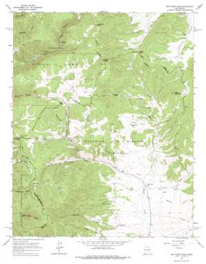
Red River Pass Topo Map New Mexico
To zoom in, hover over the map of Red River Pass
USGS Topo Quad 36105f3 - 1:24,000 scale
| Topo Map Name: | Red River Pass |
| USGS Topo Quad ID: | 36105f3 |
| Print Size: | ca. 21 1/4" wide x 27" high |
| Southeast Coordinates: | 36.625° N latitude / 105.25° W longitude |
| Map Center Coordinates: | 36.6875° N latitude / 105.3125° W longitude |
| U.S. State: | NM |
| Filename: | o36105f3.jpg |
| Download Map JPG Image: | Red River Pass topo map 1:24,000 scale |
| Map Type: | Topographic |
| Topo Series: | 7.5´ |
| Map Scale: | 1:24,000 |
| Source of Map Images: | United States Geological Survey (USGS) |
| Alternate Map Versions: |
Red River Pass NM 1963, updated 1967 Download PDF Buy paper map Red River Pass NM 1963, updated 1978 Download PDF Buy paper map Red River Pass NM 1995, updated 1997 Download PDF Buy paper map Red River Pass NM 2011 Download PDF Buy paper map Red River Pass NM 2013 Download PDF Buy paper map |
| FStopo: | US Forest Service topo Red River Pass is available: Download FStopo PDF Download FStopo TIF |
1:24,000 Topo Quads surrounding Red River Pass
> Back to 36105e1 at 1:100,000 scale
> Back to 36104a1 at 1:250,000 scale
> Back to U.S. Topo Maps home
Red River Pass topo map: Gazetteer
Red River Pass: Areas
Green Meadows elevation 2845m 9333′Red River Pass: Flats
Ditch Cabin Park elevation 3010m 9875′Hematite Park elevation 2998m 9835′
Italian Park elevation 2901m 9517′
Kentucky Park elevation 3049m 10003′
Red River Pass: Gaps
Bobcat Pass elevation 2998m 9835′Red River Pass elevation 3003m 9852′
Red River Pass: Mines
Bitter Creek Mining Company elevation 2947m 9668′Black Copper Group elevation 2893m 9491′
Black Wizard elevation 3090m 10137′
Boston Queen Prospect elevation 2789m 9150′
Challenge elevation 2978m 9770′
Cora Gibson elevation 2984m 9790′
Deldosso Prospect elevation 3048m 10000′
Elizabeth Mine elevation 2952m 9685′
Elladora elevation 2969m 9740′
Emerald elevation 2886m 9468′
Enderman Prospect elevation 2929m 9609′
Enterprise elevation 2954m 9691′
Free Gold elevation 2878m 9442′
Gem Number Two elevation 2896m 9501′
Gold Bell elevation 2943m 9655′
Gold King Number Two elevation 2927m 9603′
Gold Leaf elevation 3053m 10016′
Harmon elevation 3141m 10305′
Hemitite Chief elevation 2935m 9629′
Hidden Treasure elevation 2875m 9432′
Huntingtonia elevation 3130m 10269′
Independence elevation 2939m 9642′
Independence Mine elevation 3131m 10272′
Iron Bird elevation 2977m 9767′
Jacks and Sixes Group elevation 3033m 9950′
King Yellow Jacket elevation 2955m 9694′
Labor Exchange elevation 2924m 9593′
Manzanita elevation 2943m 9655′
Memphis Mine elevation 2978m 9770′
Misery elevation 2974m 9757′
Monitor elevation 2903m 9524′
Neptune elevation 2933m 9622′
O K elevation 2954m 9691′
Ottumay elevation 3009m 9872′
Prichard elevation 3051m 10009′
Royal elevation 2923m 9589′
Silver Queen Prospect elevation 2969m 9740′
Tyroler elevation 2949m 9675′
Varida Group elevation 3003m 9852′
Red River Pass: Parks
Foster Park elevation 3006m 9862′Red River Pass: Populated Places
Hematite (historical) elevation 2998m 9835′Moreno (historical) elevation 2635m 8645′
Red River Pass: Post Offices
Hematite Post Office (historical) elevation 2998m 9835′Red River Pass: Ranges
Taos Mountains elevation 3252m 10669′Red River Pass: Streams
Big Bobcat Creek elevation 2764m 9068′Hematite Creek elevation 2720m 8923′
Hollenback Creek elevation 2597m 8520′
Little Bobcat Creek elevation 2788m 9146′
Mill Creek elevation 2628m 8622′
North Moreno Creek elevation 2633m 8638′
Red River Pass: Summits
Black Mountain elevation 3160m 10367′Costilla Peak elevation 2974m 9757′
Tetilla Peak elevation 3275m 10744′
Van Diest Peak elevation 3389m 11118′
Red River Pass: Valleys
Blacksmith Canyon elevation 2739m 8986′Butcherknife Canyon elevation 2801m 9189′
Mud Gulch elevation 2625m 8612′
Pine Gulch elevation 2817m 9242′
Spring Gulch elevation 2610m 8562′
Red River Pass digital topo map on disk
Buy this Red River Pass topo map showing relief, roads, GPS coordinates and other geographical features, as a high-resolution digital map file on DVD:


