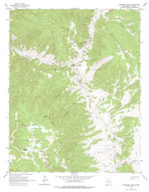
Comanche Point Topo Map New Mexico
To zoom in, hover over the map of Comanche Point
USGS Topo Quad 36105g3 - 1:24,000 scale
| Topo Map Name: | Comanche Point |
| USGS Topo Quad ID: | 36105g3 |
| Print Size: | ca. 21 1/4" wide x 27" high |
| Southeast Coordinates: | 36.75° N latitude / 105.25° W longitude |
| Map Center Coordinates: | 36.8125° N latitude / 105.3125° W longitude |
| U.S. State: | NM |
| Filename: | o36105g3.jpg |
| Download Map JPG Image: | Comanche Point topo map 1:24,000 scale |
| Map Type: | Topographic |
| Topo Series: | 7.5´ |
| Map Scale: | 1:24,000 |
| Source of Map Images: | United States Geological Survey (USGS) |
| Alternate Map Versions: |
Comanche Point NM 1963, updated 1967 Download PDF Buy paper map Comanche Point NM 1963, updated 1978 Download PDF Buy paper map Comanche Point NM 1995, updated 1997 Download PDF Buy paper map Comanche Point NM 2011 Download PDF Buy paper map Comanche Point NM 2013 Download PDF Buy paper map |
| FStopo: | US Forest Service topo Comanche Point is available: Download FStopo PDF Download FStopo TIF |
1:24,000 Topo Quads surrounding Comanche Point
> Back to 36105e1 at 1:100,000 scale
> Back to 36104a1 at 1:250,000 scale
> Back to U.S. Topo Maps home
Comanche Point topo map: Gazetteer
Comanche Point: Capes
Comanche Point elevation 2806m 9206′Comanche Point: Flats
Anderson Park elevation 3226m 10583′La Cuerva Park elevation 3326m 10912′
Comanche Point: Gaps
Lagunita Saddle elevation 3211m 10534′Comanche Point: Mines
Anchor Mine elevation 3144m 10314′Aztec Prospect elevation 2981m 9780′
Big Five Prospect elevation 3177m 10423′
Cashier Mine elevation 3208m 10524′
Criterion Claim elevation 3214m 10544′
Edison Mine elevation 3148m 10328′
Granger Placer elevation 3084m 10118′
Keystone Tunnel elevation 3183m 10442′
Little Gem Prospect elevation 3158m 10360′
Mammoth Quartz elevation 3128m 10262′
Midnight Mine elevation 3211m 10534′
Rosita elevation 3188m 10459′
Snyder Tunnel elevation 2930m 9612′
Comanche Point: Parks
Cabresto Park elevation 3252m 10669′Comanche Point: Populated Places
Anchor (historical) elevation 3144m 10314′La Belle (historical) elevation 2919m 9576′
Midnight (historical) elevation 3211m 10534′
Comanche Point: Post Offices
Midnight Post Office (historical) elevation 3211m 10534′Comanche Point: Springs
North Hole Spring elevation 3235m 10613′Comanche Point: Streams
Comanche Creek elevation 2722m 8930′Foreman Creek elevation 2852m 9356′
Gate Creek elevation 2687m 8815′
Gold Creek elevation 2804m 9199′
Grassy Creek elevation 2813m 9229′
Holman Creek elevation 2807m 9209′
La Belle Creek elevation 2818m 9245′
Little Costilla Creek elevation 2793m 9163′
Springwagon Creek elevation 2794m 9166′
Vidal Creek elevation 2842m 9324′
Comanche Point: Summits
Ortiz Peak elevation 3415m 11204′Comanche Point: Valleys
Blind Canyon elevation 2809m 9215′Chuckwagon Canyon elevation 2777m 9110′
Fernandez Canyon elevation 2745m 9005′
La Cueva Canyon elevation 2745m 9005′
Powderhouse Canyon elevation 2830m 9284′
Valle Vidal elevation 2842m 9324′
Comanche Point digital topo map on disk
Buy this Comanche Point topo map showing relief, roads, GPS coordinates and other geographical features, as a high-resolution digital map file on DVD:


