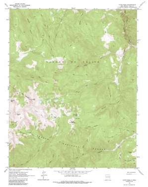
Latir Peak Topo Map New Mexico
To zoom in, hover over the map of Latir Peak
USGS Topo Quad 36105g4 - 1:24,000 scale
| Topo Map Name: | Latir Peak |
| USGS Topo Quad ID: | 36105g4 |
| Print Size: | ca. 21 1/4" wide x 27" high |
| Southeast Coordinates: | 36.75° N latitude / 105.375° W longitude |
| Map Center Coordinates: | 36.8125° N latitude / 105.4375° W longitude |
| U.S. State: | NM |
| Filename: | o36105g4.jpg |
| Download Map JPG Image: | Latir Peak topo map 1:24,000 scale |
| Map Type: | Topographic |
| Topo Series: | 7.5´ |
| Map Scale: | 1:24,000 |
| Source of Map Images: | United States Geological Survey (USGS) |
| Alternate Map Versions: |
Latir Peak NM 1963, updated 1967 Download PDF Buy paper map Latir Peak NM 1963, updated 1973 Download PDF Buy paper map Latir Peak NM 1963, updated 1986 Download PDF Buy paper map Latir Peak NM 1995, updated 1997 Download PDF Buy paper map Latir Peak NM 2011 Download PDF Buy paper map Latir Peak NM 2013 Download PDF Buy paper map |
| FStopo: | US Forest Service topo Latir Peak is available: Download FStopo PDF Download FStopo TIF |
1:24,000 Topo Quads surrounding Latir Peak
> Back to 36105e1 at 1:100,000 scale
> Back to 36104a1 at 1:250,000 scale
> Back to U.S. Topo Maps home
Latir Peak topo map: Gazetteer
Latir Peak: Lakes
Baldy Blue Lake elevation 3442m 11292′Bear Lake elevation 3498m 11476′
Heart Lake elevation 3507m 11505′
Latir Lakes elevation 3519m 11545′
South Latir Lake elevation 3519m 11545′
Latir Peak: Mines
Baldy Peak Claim Mine elevation 2951m 9681′Billy Goat Claim elevation 2951m 9681′
Latir Claim elevation 2951m 9681′
Spanish Main Prospect elevation 2812m 9225′
Latir Peak: Parks
Latir Rock Cairn elevation 3706m 12158′Latir Peak: Streams
Bull Creek elevation 3222m 10570′Lagunitas Fork elevation 3079m 10101′
Latir Creek elevation 2663m 8736′
Lemos Creek elevation 2695m 8841′
Midnight Creek elevation 2788m 9146′
Rito Claro elevation 2882m 9455′
Latir Peak: Summits
Baldy Mountain elevation 3672m 12047′Greenie Peak elevation 3429m 11250′
Latir Mesa elevation 3870m 12696′
Latir Peak elevation 3862m 12670′
Venado Peak elevation 3880m 12729′
Virsylvia Peak elevation 3820m 12532′
Latir Peak: Valleys
Jiron Canyon elevation 3049m 10003′Virgin Canyon elevation 3519m 11545′
Latir Peak digital topo map on disk
Buy this Latir Peak topo map showing relief, roads, GPS coordinates and other geographical features, as a high-resolution digital map file on DVD:


