Sunshine Topo Map New Mexico
To zoom in, hover over the map of Sunshine
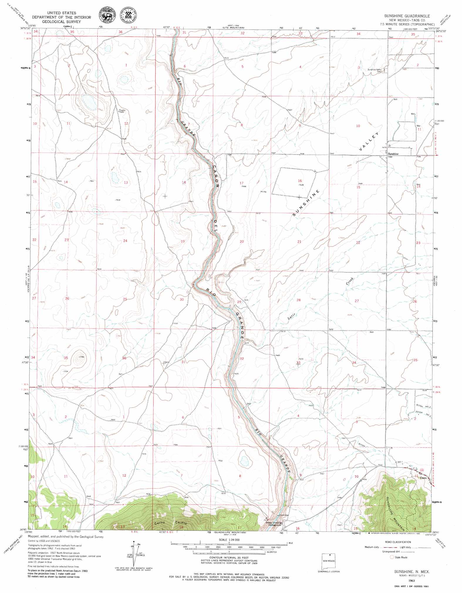
USGS Topo Quad 36105g6 - 1:24,000 scale
| Topo Map Name: | Sunshine |
| USGS Topo Quad ID: | 36105g6 |
| Print Size: | ca. 21 1/4" wide x 27" high |
| Southeast Coordinates: | 36.75° N latitude / 105.625° W longitude |
| Map Center Coordinates: | 36.8125° N latitude / 105.6875° W longitude |
| U.S. State: | NM |
| Filename: | o36105g6.jpg |
| Download Map JPG Image: | Sunshine topo map 1:24,000 scale |
| Map Type: | Topographic |
| Topo Series: | 7.5´ |
| Map Scale: | 1:24,000 |
| Source of Map Images: | United States Geological Survey (USGS) |
| Alternate Map Versions: |
Sunshine NM 1963, updated 1967 Download PDF Buy paper map Sunshine NM 1963, updated 1980 Download PDF Buy paper map Sunshine NM 2010 Download PDF Buy paper map Sunshine NM 2013 Download PDF Buy paper map |
1:24,000 Topo Quads surrounding Sunshine
Lobatos |
Kiowa Hill |
Sky Valley Ranch |
Garcia |
Sanchez Reservoir |
Pinabetoso Peaks |
La Segita Peaks Ne |
Ute Mountain |
Costilla |
Amalia |
La Segita Peaks |
Cerro De La Olla |
Sunshine |
Cerro |
Latir Peak |
Tres Piedras |
Tres Piedras Ne |
Guadalupe Mountain |
Questa |
Red River |
Petaca Peak |
Cerro De Los Taoses |
Arroyo Hondo |
Arroyo Seco |
Wheeler Peak |
> Back to 36105e1 at 1:100,000 scale
> Back to 36104a1 at 1:250,000 scale
> Back to U.S. Topo Maps home
Sunshine topo map: Gazetteer
Sunshine: Canals
Number One Ditch elevation 2294m 7526′Sunshine: Populated Places
Sunshine elevation 2282m 7486′Sunshine Valley elevation 2269m 7444′
Sunshine: Post Offices
Sunshine Valley Post Office elevation 2269m 7444′Sunshine: Streams
Latir Creek elevation 2209m 7247′Sunshine: Valleys
Sunshine Valley elevation 2226m 7303′Sunshine: Wells
10031 Water Well elevation 2293m 7522′10033 Water Well elevation 2301m 7549′
10053 Water Well elevation 2268m 7440′
PubSup Water Well 2 elevation 2298m 7539′
Test Hole R2 Water Well elevation 2272m 7454′
Test Hole R5 Water Well elevation 2290m 7513′
Testhole 2 Water Well elevation 2265m 7431′
Testhole 5 Water Well elevation 2269m 7444′
Testhole R1 Water Well elevation 2261m 7417′
Well 1 Water Well elevation 2282m 7486′
Well 4 Water Well elevation 2279m 7477′
Sunshine digital topo map on disk
Buy this Sunshine topo map showing relief, roads, GPS coordinates and other geographical features, as a high-resolution digital map file on DVD: