Cerro De La Olla Topo Map New Mexico
To zoom in, hover over the map of Cerro De La Olla
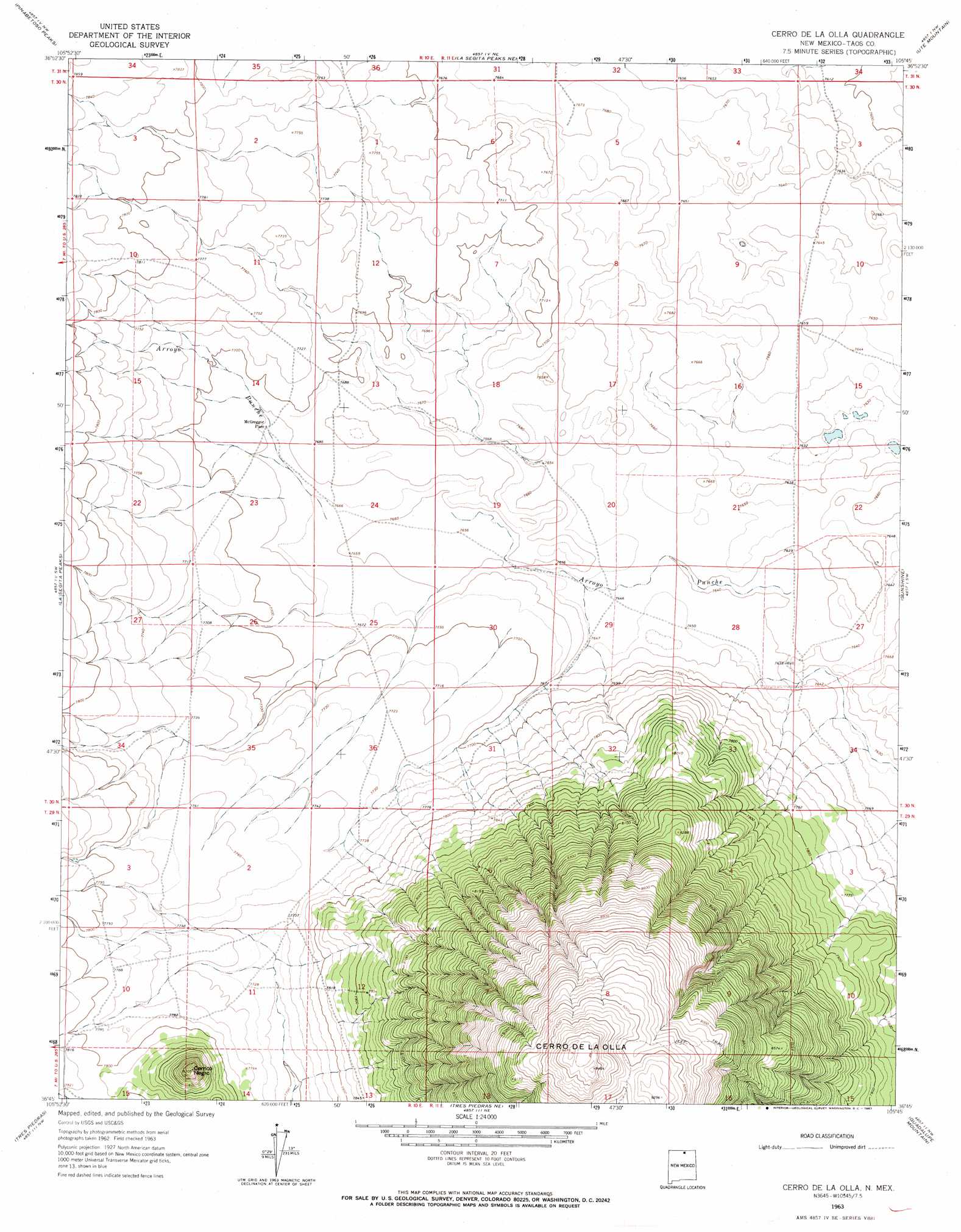
USGS Topo Quad 36105g7 - 1:24,000 scale
| Topo Map Name: | Cerro De La Olla |
| USGS Topo Quad ID: | 36105g7 |
| Print Size: | ca. 21 1/4" wide x 27" high |
| Southeast Coordinates: | 36.75° N latitude / 105.75° W longitude |
| Map Center Coordinates: | 36.8125° N latitude / 105.8125° W longitude |
| U.S. State: | NM |
| Filename: | o36105g7.jpg |
| Download Map JPG Image: | Cerro De La Olla topo map 1:24,000 scale |
| Map Type: | Topographic |
| Topo Series: | 7.5´ |
| Map Scale: | 1:24,000 |
| Source of Map Images: | United States Geological Survey (USGS) |
| Alternate Map Versions: |
Cerro De La Olla NM 1963, updated 1967 Download PDF Buy paper map Cerro De La Olla NM 2010 Download PDF Buy paper map Cerro De La Olla NM 2013 Download PDF Buy paper map Cerro De La Olla NM 2017 Download PDF Buy paper map |
1:24,000 Topo Quads surrounding Cerro De La Olla
Antonito |
Lobatos |
Kiowa Hill |
Sky Valley Ranch |
Garcia |
Los Pinos |
Pinabetoso Peaks |
La Segita Peaks Ne |
Ute Mountain |
Costilla |
San Antonio Mountain |
La Segita Peaks |
Cerro De La Olla |
Sunshine |
Cerro |
Mule Canyon |
Tres Piedras |
Tres Piedras Ne |
Guadalupe Mountain |
Questa |
Las Tablas |
Petaca Peak |
Cerro De Los Taoses |
Arroyo Hondo |
Arroyo Seco |
> Back to 36105e1 at 1:100,000 scale
> Back to 36104a1 at 1:250,000 scale
> Back to U.S. Topo Maps home
Cerro De La Olla topo map: Gazetteer
Cerro De La Olla: Populated Places
McGreggor Place elevation 2342m 7683′Cerro De La Olla: Streams
Arroyo Punche elevation 2330m 7644′Cerro De La Olla: Summits
Cerrito Negro elevation 2500m 8202′Cerro de la Olla elevation 2888m 9475′
Cerro De La Olla: Wells
NM SEO Water Well elevation 2330m 7644′RG-37145 Water Well elevation 2361m 7746′
Testhole R10 Water Well elevation 2330m 7644′
Cerro De La Olla digital topo map on disk
Buy this Cerro De La Olla topo map showing relief, roads, GPS coordinates and other geographical features, as a high-resolution digital map file on DVD: