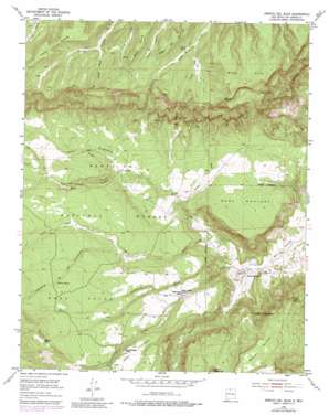
Arroyo Del Agua Topo Map New Mexico
To zoom in, hover over the map of Arroyo Del Agua
USGS Topo Quad 36106b6 - 1:24,000 scale
| Topo Map Name: | Arroyo Del Agua |
| USGS Topo Quad ID: | 36106b6 |
| Print Size: | ca. 21 1/4" wide x 27" high |
| Southeast Coordinates: | 36.125° N latitude / 106.625° W longitude |
| Map Center Coordinates: | 36.1875° N latitude / 106.6875° W longitude |
| U.S. State: | NM |
| Filename: | o36106b6.jpg |
| Download Map JPG Image: | Arroyo Del Agua topo map 1:24,000 scale |
| Map Type: | Topographic |
| Topo Series: | 7.5´ |
| Map Scale: | 1:24,000 |
| Source of Map Images: | United States Geological Survey (USGS) |
| Alternate Map Versions: |
Arroyo Del Agua NM 1953, updated 1955 Download PDF Buy paper map Arroyo Del Agua NM 1953, updated 1976 Download PDF Buy paper map Arroyo Del Agua NM 1953, updated 1980 Download PDF Buy paper map Arroyo Del Agua NM 1953, updated 1983 Download PDF Buy paper map Arroyo Del Agua NM 2002, updated 2003 Download PDF Buy paper map Arroyo Del Agua NM 2011 Download PDF Buy paper map Arroyo Del Agua NM 2013 Download PDF Buy paper map Arroyo Del Agua NM 2017 Download PDF Buy paper map |
| FStopo: | US Forest Service topo Arroyo Del Agua is available: Download FStopo PDF Download FStopo TIF |
1:24,000 Topo Quads surrounding Arroyo Del Agua
> Back to 36106a1 at 1:100,000 scale
> Back to 36106a1 at 1:250,000 scale
> Back to U.S. Topo Maps home
Arroyo Del Agua topo map: Gazetteer
Arroyo Del Agua: Benches
Mesa Poleo elevation 2438m 7998′Arroyo Del Agua: Forests
Coyote Ranger District elevation 2219m 7280′Arroyo Del Agua: Mines
Jaramillo-Montoya elevation 2040m 6692′Resurrection elevation 2099m 6886′
Arroyo Del Agua: Populated Places
Arroyo del Agua elevation 2083m 6833′Santa Teresa elevation 2270m 7447′
Arroyo Del Agua: Reservoirs
Jaspe Trick Tank elevation 2228m 7309′La Cueba Tank elevation 2359m 7739′
Mesa Alta Wildlife Trick Tank elevation 2680m 8792′
Morfins Tank elevation 2572m 8438′
Navajo Tank elevation 2188m 7178′
Navajo Trick Tank elevation 2239m 7345′
Salazar Tank elevation 2524m 8280′
South Salitral Trick Tank elevation 2261m 7417′
West Trick Tank elevation 2221m 7286′
Arroyo Del Agua: Ridges
Cuesta Navajo elevation 2399m 7870′Arroyo Del Agua: Springs
Bear Spring elevation 2585m 8480′Canada Spring elevation 2658m 8720′
Casey Spring elevation 2551m 8369′
Cordovas Spring elevation 2435m 7988′
Dead Horse Spring elevation 2645m 8677′
Escondido Spring elevation 2546m 8353′
Fuertes Spring elevation 2526m 8287′
Gurule Spring elevation 2585m 8480′
Lino Spring elevation 2412m 7913′
Ojitos Spring elevation 2445m 8021′
Salitral Spring elevation 2170m 7119′
Sandy Deer Spring elevation 2666m 8746′
Sarca Spring elevation 2415m 7923′
Upper Potrero Spring elevation 2543m 8343′
Arroyo Del Agua: Streams
Agua Sarca elevation 2089m 6853′Arroyo Jaspe elevation 2138m 7014′
Cañada Brazo elevation 2565m 8415′
Cañada Tusas elevation 2511m 8238′
Lino Creek elevation 2349m 7706′
Poleo Creek elevation 2049m 6722′
Salitral Creek elevation 2068m 6784′
Arroyo Del Agua: Summits
Loma Coyote elevation 2363m 7752′Mesa Alta elevation 2719m 8920′
Mesa Corral elevation 2669m 8756′
Mesa del Camino elevation 2655m 8710′
Mesa Gurule elevation 2758m 9048′
Mesa Montosa elevation 2331m 7647′
Mesa Ojitos elevation 2465m 8087′
Mesa Pinabetal elevation 2419m 7936′
Arroyo Del Agua: Valleys
Cañon Ojo elevation 2223m 7293′Cañon Pinabetoso elevation 2197m 7208′
Cañoncito de los Cordovas elevation 2290m 7513′
Cañoncito Seco elevation 2076m 6811′
Arroyo Del Agua digital topo map on disk
Buy this Arroyo Del Agua topo map showing relief, roads, GPS coordinates and other geographical features, as a high-resolution digital map file on DVD:


