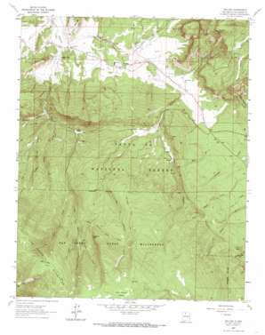
Gallina Topo Map New Mexico
To zoom in, hover over the map of Gallina
USGS Topo Quad 36106b7 - 1:24,000 scale
| Topo Map Name: | Gallina |
| USGS Topo Quad ID: | 36106b7 |
| Print Size: | ca. 21 1/4" wide x 27" high |
| Southeast Coordinates: | 36.125° N latitude / 106.75° W longitude |
| Map Center Coordinates: | 36.1875° N latitude / 106.8125° W longitude |
| U.S. State: | NM |
| Filename: | o36106b7.jpg |
| Download Map JPG Image: | Gallina topo map 1:24,000 scale |
| Map Type: | Topographic |
| Topo Series: | 7.5´ |
| Map Scale: | 1:24,000 |
| Source of Map Images: | United States Geological Survey (USGS) |
| Alternate Map Versions: |
Gallina NM 1963, updated 1966 Download PDF Buy paper map Gallina NM 2002, updated 2003 Download PDF Buy paper map Gallina NM 2011 Download PDF Buy paper map Gallina NM 2013 Download PDF Buy paper map Gallina NM 2017 Download PDF Buy paper map |
| FStopo: | US Forest Service topo Gallina is available: Download FStopo PDF Download FStopo TIF |
1:24,000 Topo Quads surrounding Gallina
> Back to 36106a1 at 1:100,000 scale
> Back to 36106a1 at 1:250,000 scale
> Back to U.S. Topo Maps home
Gallina topo map: Gazetteer
Gallina: Cliffs
Red Rock Cliff elevation 2955m 9694′Gallina: Mines
TJBD 1 elevation 2434m 7985′Wild Blue elevation 3130m 10269′
Gallina: Populated Places
Capulin elevation 2302m 7552′Gallina: Post Offices
Capulin Post Office elevation 2302m 7552′Gallina: Springs
Cecilia Spring elevation 2484m 8149′Chavez SPring elevation 2468m 8097′
Lime Spring elevation 2779m 9117′
Gallina: Streams
Cave Creek elevation 2728m 8950′Clear Creek elevation 2351m 7713′
Corralitos Creek elevation 3079m 10101′
Dove Creek elevation 2529m 8297′
Jose Miguel Creek elevation 2412m 7913′
Rio Capulin elevation 2207m 7240′
Rito del Ojo elevation 2359m 7739′
Gallina: Summits
Capulin Peak elevation 2804m 9199′Gallina: Trails
River Trail elevation 2655m 8710′San Jose Trail elevation 3116m 10223′
San Pedro Mountain Trail elevation 2875m 9432′
San Pedro Parks Trail elevation 2855m 9366′
Upper Gallina River Trail elevation 2942m 9652′
Gallina: Valleys
Cañon Capulin elevation 2207m 7240′Cañon de la Vegitas elevation 2334m 7657′
Cecilia Canyon elevation 2446m 8024′
Corral Canyon elevation 2321m 7614′
Salt Draw elevation 2188m 7178′
Gallina digital topo map on disk
Buy this Gallina topo map showing relief, roads, GPS coordinates and other geographical features, as a high-resolution digital map file on DVD:


