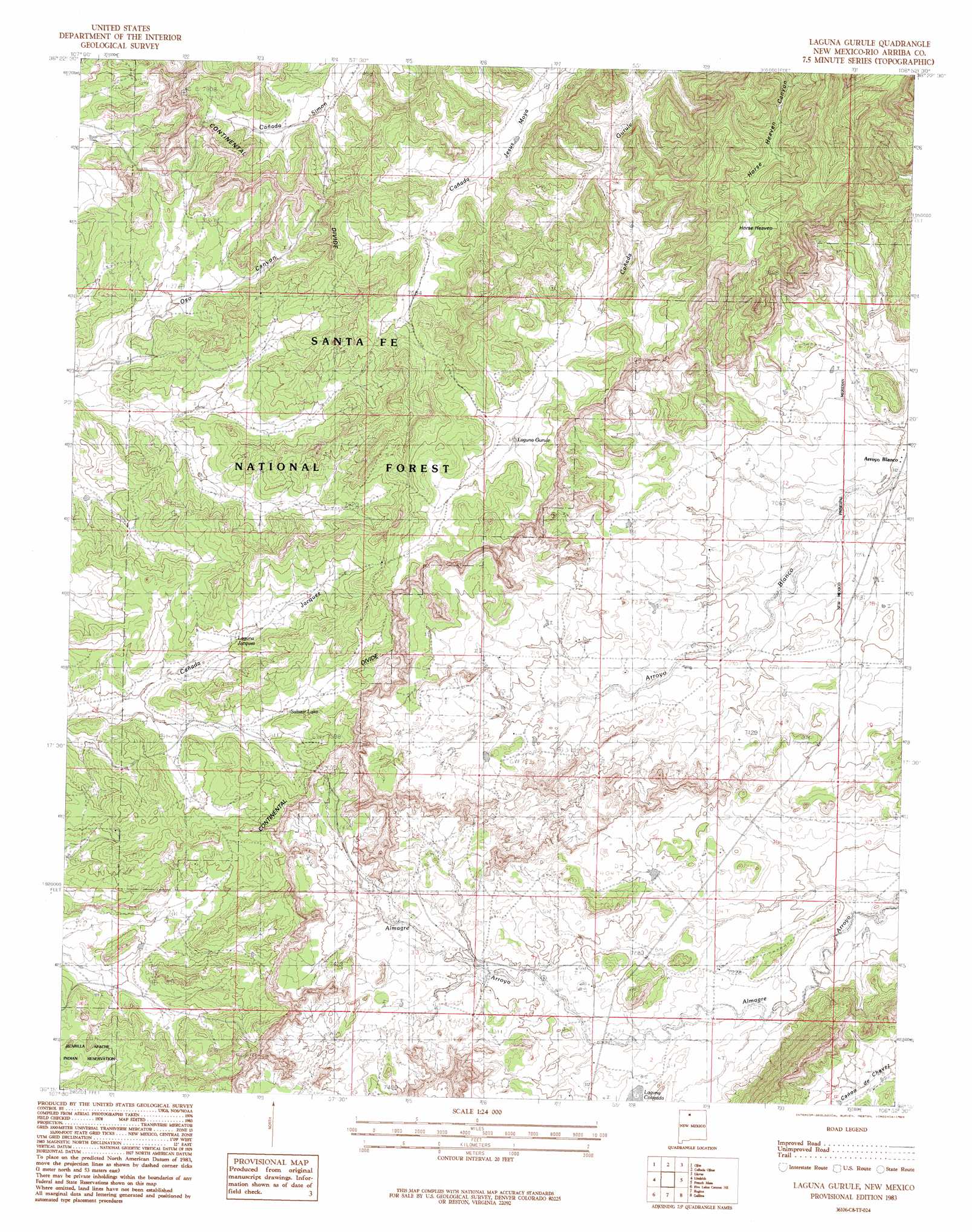
Laguna Gurule Topo Map New Mexico
To zoom in, hover over the map of Laguna Gurule
USGS Topo Quad 36106c8 - 1:24,000 scale
| Topo Map Name: | Laguna Gurule |
| USGS Topo Quad ID: | 36106c8 |
| Print Size: | ca. 21 1/4" wide x 27" high |
| Southeast Coordinates: | 36.25° N latitude / 106.875° W longitude |
| Map Center Coordinates: | 36.3125° N latitude / 106.9375° W longitude |
| U.S. State: | NM |
| Filename: | o36106c8.jpg |
| Download Map JPG Image: | Laguna Gurule topo map 1:24,000 scale |
| Map Type: | Topographic |
| Topo Series: | 7.5´ |
| Map Scale: | 1:24,000 |
| Source of Map Images: | United States Geological Survey (USGS) |
| Alternate Map Versions: |
Laguna Gurule NM 1983, updated 1983 Download PDF Buy paper map Laguna Gurule NM 2002, updated 2003 Download PDF Buy paper map Laguna Gurule NM 2011 Download PDF Buy paper map Laguna Gurule NM 2013 Download PDF Buy paper map Laguna Gurule NM 2017 Download PDF Buy paper map |
| FStopo: | US Forest Service topo Laguna Gurule is available: Download FStopo PDF Download FStopo TIF |
1:24,000 Topo Quads surrounding Laguna Gurule
Pine Lake |
Leavry Canyon |
Los Indios Canyon |
Pounds Mesa |
El Vado |
Schmitz Ranch |
Ojito |
Canada Ojitos |
Llaves |
Navajo Peak |
Billy Rice Canyon |
Lindrith |
Laguna Gurule |
French Mesa |
Laguna Peak |
Five Lakes Canyon Nw |
Five Lakes Canyon Ne |
Regina |
Gallina |
Arroyo Del Agua |
Taylor Ranch |
Arroyo Chijuillita |
Cuba |
Nacimiento Peak |
Jarosa |
> Back to 36106a1 at 1:100,000 scale
> Back to 36106a1 at 1:250,000 scale
> Back to U.S. Topo Maps home
Laguna Gurule topo map: Gazetteer
Laguna Gurule: Areas
Questecita Blanca elevation 2224m 7296′Laguna Gurule: Lakes
Laguna Colorada elevation 2217m 7273′Laguna Gurule: Reservoirs
Laguna Gurule elevation 2275m 7463′Laguna Jacquez elevation 2286m 7500′
Lee Tank elevation 2253m 7391′
Oso Tank elevation 2247m 7372′
Laguna Gurule: Summits
Horse Heaven elevation 2380m 7808′Laguna Gurule: Wells
Nelson Wells elevation 2260m 7414′Laguna Gurule digital topo map on disk
Buy this Laguna Gurule topo map showing relief, roads, GPS coordinates and other geographical features, as a high-resolution digital map file on DVD: