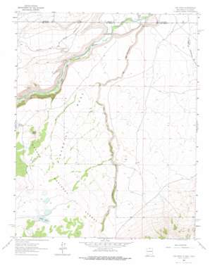
Los Pinos Topo Map New Mexico
To zoom in, hover over the map of Los Pinos
USGS Topo Quad 36106h1 - 1:24,000 scale
| Topo Map Name: | Los Pinos |
| USGS Topo Quad ID: | 36106h1 |
| Print Size: | ca. 21 1/4" wide x 27" high |
| Southeast Coordinates: | 36.875° N latitude / 106° W longitude |
| Map Center Coordinates: | 36.9375° N latitude / 106.0625° W longitude |
| U.S. States: | NM, CO |
| Filename: | o36106h1.jpg |
| Download Map JPG Image: | Los Pinos topo map 1:24,000 scale |
| Map Type: | Topographic |
| Topo Series: | 7.5´ |
| Map Scale: | 1:24,000 |
| Source of Map Images: | United States Geological Survey (USGS) |
| Alternate Map Versions: |
Los Pinos NM 1963, updated 1967 Download PDF Buy paper map Los Pinos NM 1963, updated 1978 Download PDF Buy paper map Los Pinos NM 1995, updated 1998 Download PDF Buy paper map Los Pinos NM 2011 Download PDF Buy paper map Los Pinos NM 2013 Download PDF Buy paper map |
| FStopo: | US Forest Service topo Los Pinos is available: Download FStopo PDF Download FStopo TIF |
1:24,000 Topo Quads surrounding Los Pinos
> Back to 36106e1 at 1:100,000 scale
> Back to 36106a1 at 1:250,000 scale
> Back to U.S. Topo Maps home
Los Pinos topo map: Gazetteer
Los Pinos: Lakes
Laguna Larga elevation 2745m 9005′Los Pinos: Mines
Cisnero Mine Number One elevation 2739m 8986′Los Pinos: Parks
San Antonio Wilderness Study Area elevation 2539m 8330′Los Pinos: Populated Places
Lava elevation 2594m 8510′Los Pinos elevation 2452m 8044′
Los Pinos: Post Offices
Lava Post Office (historical) elevation 2594m 8510′Los Pinos: Reservoirs
Big Horn Siding Rail Road Water Tank elevation 2593m 8507′Chino Peak Tank elevation 2650m 8694′
Chino Tank elevation 2698m 8851′
Llano Tank elevation 2650m 8694′
Pit Tank elevation 2755m 9038′
Pit Tank Number Three elevation 2773m 9097′
Pit Tank Number Two elevation 2736m 8976′
Los Pinos: Streams
Cañada los Ranchos elevation 2504m 8215′Rio de los Pinos elevation 2428m 7965′
Los Pinos: Summits
Chino Peak elevation 2745m 9005′Pinabetal Mesa elevation 2602m 8536′
Los Pinos digital topo map on disk
Buy this Los Pinos topo map showing relief, roads, GPS coordinates and other geographical features, as a high-resolution digital map file on DVD:


