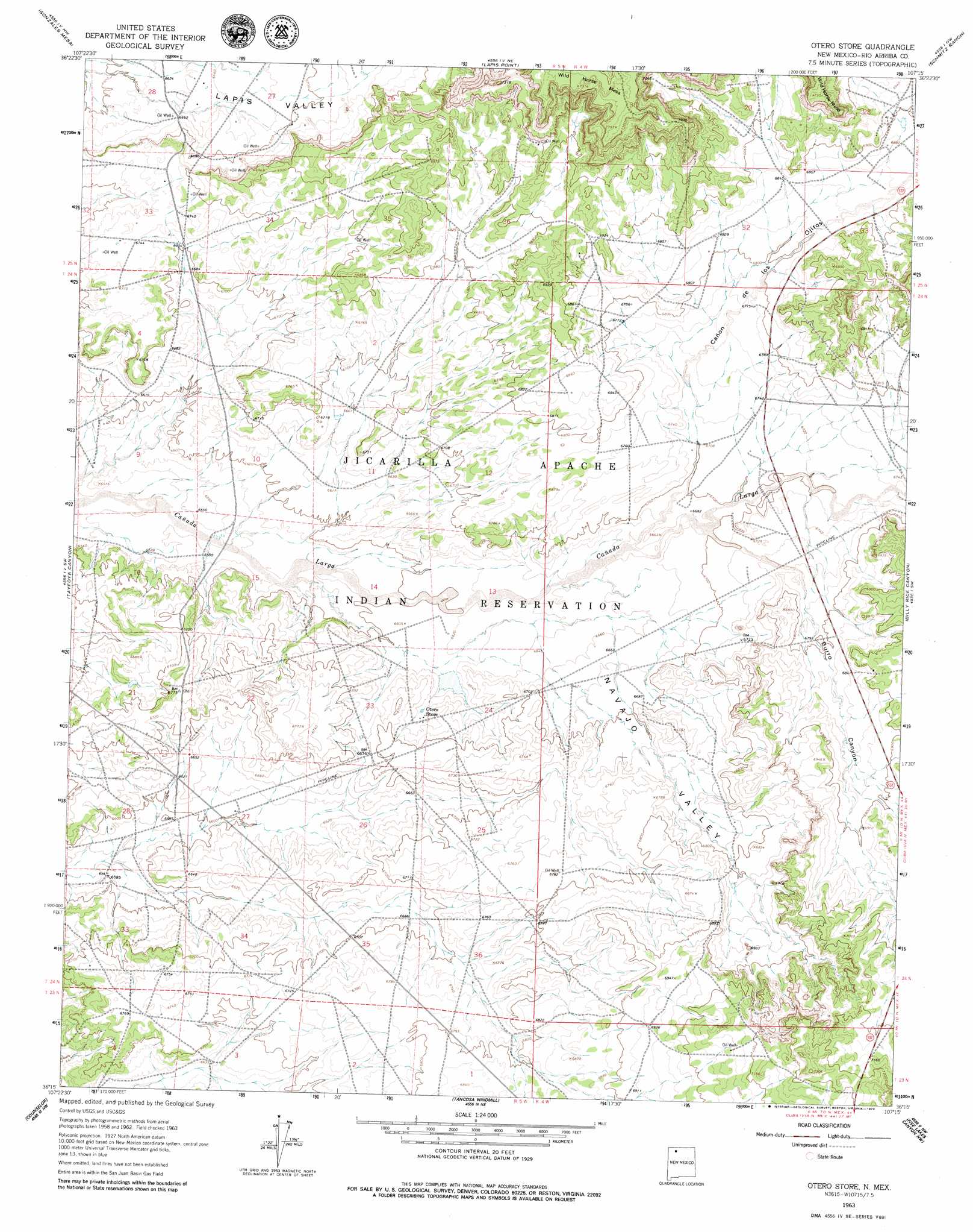
Otero Store Topo Map New Mexico
To zoom in, hover over the map of Otero Store
USGS Topo Quad 36107c3 - 1:24,000 scale
| Topo Map Name: | Otero Store |
| USGS Topo Quad ID: | 36107c3 |
| Print Size: | ca. 21 1/4" wide x 27" high |
| Southeast Coordinates: | 36.25° N latitude / 107.25° W longitude |
| Map Center Coordinates: | 36.3125° N latitude / 107.3125° W longitude |
| U.S. State: | NM |
| Filename: | o36107c3.jpg |
| Download Map JPG Image: | Otero Store topo map 1:24,000 scale |
| Map Type: | Topographic |
| Topo Series: | 7.5´ |
| Map Scale: | 1:24,000 |
| Source of Map Images: | United States Geological Survey (USGS) |
| Alternate Map Versions: |
Otero Store NM 1963, updated 1965 Download PDF Buy paper map Otero Store NM 1963, updated 1979 Download PDF Buy paper map Otero Store NM 2010 Download PDF Buy paper map Otero Store NM 2013 Download PDF Buy paper map Otero Store NM 2017 Download PDF Buy paper map |
1:24,000 Topo Quads surrounding Otero Store
Gould Pass |
Santos Peak |
Vigas Canyon |
Pine Lake |
Leavry Canyon |
Smouse Mesa |
Gonzales Mesa |
Lapis Point |
Schmitz Ranch |
Ojito |
Crow Mesa East |
Tafoya Canyon |
Otero Store |
Billy Rice Canyon |
Lindrith |
Lybrook |
Counselor |
Tancosa Windmill |
Five Lakes Canyon Nw |
Five Lakes Canyon Ne |
Lybrook Se |
Mule Dam |
Deer Mesa |
Taylor Ranch |
Arroyo Chijuillita |
> Back to 36107a1 at 1:100,000 scale
> Back to 36106a1 at 1:250,000 scale
> Back to U.S. Topo Maps home
Otero Store topo map: Gazetteer
Otero Store: Springs
H C Berry Spring elevation 2036m 6679′Otero Store: Valleys
Burro Canyon elevation 2042m 6699′Cañon de los Ojitos elevation 2031m 6663′
Navajo Valley elevation 2002m 6568′
Otero Store: Wells
Bia 10 Water Well elevation 2092m 6863′L Velarde Number 1 Water Well elevation 2069m 6788′
Largo Water Well elevation 2056m 6745′
Leeper Number 2 Water Well elevation 2104m 6902′
Old Crow Water Well elevation 2066m 6778′
Otero Water Well elevation 2025m 6643′
Otero Store digital topo map on disk
Buy this Otero Store topo map showing relief, roads, GPS coordinates and other geographical features, as a high-resolution digital map file on DVD: