Schmitz Ranch Topo Map New Mexico
To zoom in, hover over the map of Schmitz Ranch
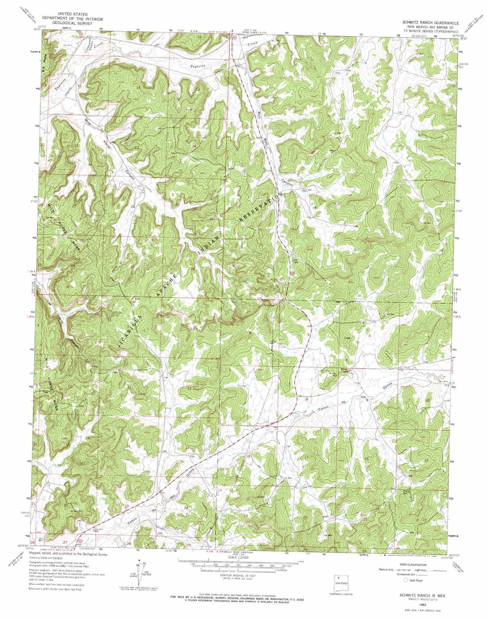
USGS Topo Quad 36107d2 - 1:24,000 scale
| Topo Map Name: | Schmitz Ranch |
| USGS Topo Quad ID: | 36107d2 |
| Print Size: | ca. 21 1/4" wide x 27" high |
| Southeast Coordinates: | 36.375° N latitude / 107.125° W longitude |
| Map Center Coordinates: | 36.4375° N latitude / 107.1875° W longitude |
| U.S. State: | NM |
| Filename: | o36107d2.jpg |
| Download Map JPG Image: | Schmitz Ranch topo map 1:24,000 scale |
| Map Type: | Topographic |
| Topo Series: | 7.5´ |
| Map Scale: | 1:24,000 |
| Source of Map Images: | United States Geological Survey (USGS) |
| Alternate Map Versions: |
Schmitz Ranch NM 1963, updated 1965 Download PDF Buy paper map Schmitz Ranch NM 2010 Download PDF Buy paper map Schmitz Ranch NM 2013 Download PDF Buy paper map Schmitz Ranch NM 2017 Download PDF Buy paper map |
1:24,000 Topo Quads surrounding Schmitz Ranch
Fourmile Canyon |
Gobernador |
Leandro Canyon |
Cement Lake |
Cedar Canyon |
Santos Peak |
Vigas Canyon |
Pine Lake |
Leavry Canyon |
Los Indios Canyon |
Gonzales Mesa |
Lapis Point |
Schmitz Ranch |
Ojito |
Canada Ojitos |
Tafoya Canyon |
Otero Store |
Billy Rice Canyon |
Lindrith |
Laguna Gurule |
Counselor |
Tancosa Windmill |
Five Lakes Canyon Nw |
Five Lakes Canyon Ne |
Regina |
> Back to 36107a1 at 1:100,000 scale
> Back to 36106a1 at 1:250,000 scale
> Back to U.S. Topo Maps home
Schmitz Ranch topo map: Gazetteer
Schmitz Ranch: Valleys
Bull Well Canyon elevation 2098m 6883′Cedar Canyon elevation 2098m 6883′
Cottonwood Canyon elevation 2061m 6761′
Wild Horse Canyon elevation 2052m 6732′
Schmitz Ranch: Wells
Bridge Water Well elevation 2063m 6768′Bull Well elevation 2157m 7076′
Ojito Well elevation 2118m 6948′
Wild Horse Canyon Water Well elevation 2090m 6856′
Schmitz Ranch digital topo map on disk
Buy this Schmitz Ranch topo map showing relief, roads, GPS coordinates and other geographical features, as a high-resolution digital map file on DVD: