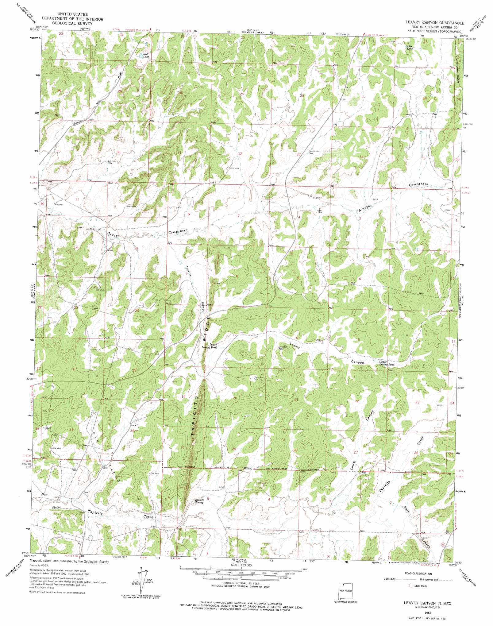
Leavry Canyon Topo Map New Mexico
To zoom in, hover over the map of Leavry Canyon
USGS Topo Quad 36107e1 - 1:24,000 scale
| Topo Map Name: | Leavry Canyon |
| USGS Topo Quad ID: | 36107e1 |
| Print Size: | ca. 21 1/4" wide x 27" high |
| Southeast Coordinates: | 36.5° N latitude / 107° W longitude |
| Map Center Coordinates: | 36.5625° N latitude / 107.0625° W longitude |
| U.S. State: | NM |
| Filename: | o36107e1.jpg |
| Download Map JPG Image: | Leavry Canyon topo map 1:24,000 scale |
| Map Type: | Topographic |
| Topo Series: | 7.5´ |
| Map Scale: | 1:24,000 |
| Source of Map Images: | United States Geological Survey (USGS) |
| Alternate Map Versions: |
Leavry Canyon NM 1963, updated 1966 Download PDF Buy paper map Leavry Canyon NM 1963, updated 1975 Download PDF Buy paper map Leavry Canyon NM 2010 Download PDF Buy paper map Leavry Canyon NM 2013 Download PDF Buy paper map Leavry Canyon NM 2017 Download PDF Buy paper map |
1:24,000 Topo Quads surrounding Leavry Canyon
Espinosa Ranch |
Bixler Ranch |
John Mills Lake |
Cordova Canyon |
Horse Lake |
Gobernador |
Leandro Canyon |
Cement Lake |
Cedar Canyon |
Apache Mesa |
Vigas Canyon |
Pine Lake |
Leavry Canyon |
Los Indios Canyon |
Pounds Mesa |
Lapis Point |
Schmitz Ranch |
Ojito |
Canada Ojitos |
Llaves |
Otero Store |
Billy Rice Canyon |
Lindrith |
Laguna Gurule |
French Mesa |
> Back to 36107e1 at 1:100,000 scale
> Back to 36106a1 at 1:250,000 scale
> Back to U.S. Topo Maps home
Leavry Canyon topo map: Gazetteer
Leavry Canyon: Lakes
Lower Leavry Pond elevation 2188m 7178′Upper Leavry Pond elevation 2241m 7352′
Leavry Canyon: Reservoirs
Red Lake elevation 2190m 7185′Tule Lake elevation 2252m 7388′
Leavry Canyon: Ridges
Tapicito Ridge elevation 2269m 7444′Leavry Canyon: Springs
Bassett Spring elevation 2162m 7093′Leavry Canyon: Valleys
Bear Canyon elevation 2208m 7244′Chico Canyon elevation 2198m 7211′
Leavry Canyon elevation 2137m 7011′
Leavry Canyon: Wells
Edward Velarde Water Well elevation 2180m 7152′Five Tanks Water Well elevation 2141m 7024′
Garambulla Water Well elevation 2176m 7139′
Garambulla Well elevation 2176m 7139′
L Garambullo Water Well elevation 2170m 7119′
Lincoln Velarde Water Well elevation 2191m 7188′
Robert Imel Water Well elevation 2207m 7240′
Leavry Canyon digital topo map on disk
Buy this Leavry Canyon topo map showing relief, roads, GPS coordinates and other geographical features, as a high-resolution digital map file on DVD: