Pine Lake Topo Map New Mexico
To zoom in, hover over the map of Pine Lake
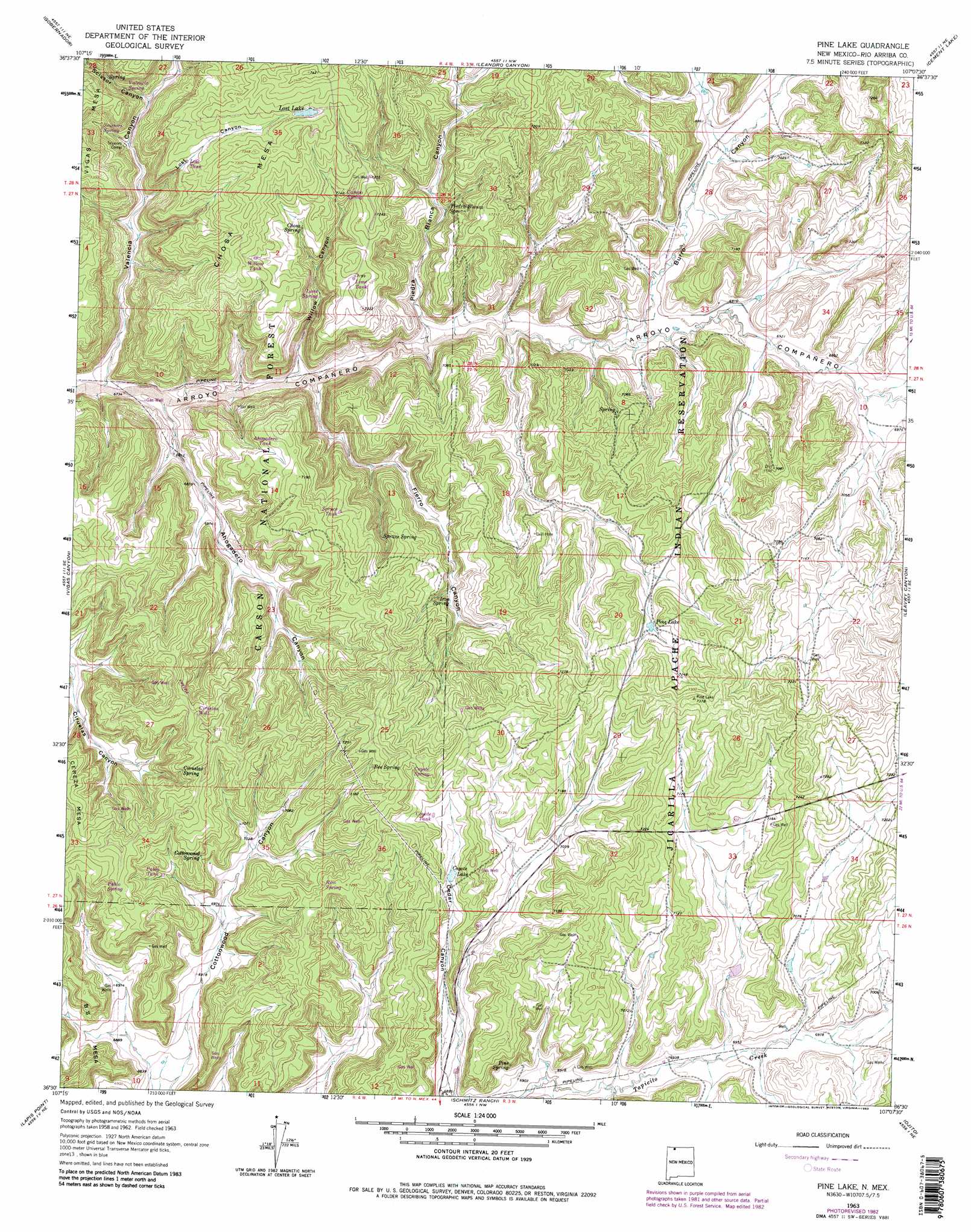
USGS Topo Quad 36107e2 - 1:24,000 scale
| Topo Map Name: | Pine Lake |
| USGS Topo Quad ID: | 36107e2 |
| Print Size: | ca. 21 1/4" wide x 27" high |
| Southeast Coordinates: | 36.5° N latitude / 107.125° W longitude |
| Map Center Coordinates: | 36.5625° N latitude / 107.1875° W longitude |
| U.S. State: | NM |
| Filename: | o36107e2.jpg |
| Download Map JPG Image: | Pine Lake topo map 1:24,000 scale |
| Map Type: | Topographic |
| Topo Series: | 7.5´ |
| Map Scale: | 1:24,000 |
| Source of Map Images: | United States Geological Survey (USGS) |
| Alternate Map Versions: |
Pine Lake NM 1963, updated 1966 Download PDF Buy paper map Pine Lake NM 1963, updated 1975 Download PDF Buy paper map Pine Lake NM 1963, updated 1983 Download PDF Buy paper map Pine Lake NM 1995, updated 1997 Download PDF Buy paper map Pine Lake NM 2011 Download PDF Buy paper map Pine Lake NM 2013 Download PDF Buy paper map Pine Lake NM 2017 Download PDF Buy paper map |
| FStopo: | US Forest Service topo Pine Lake is available: Download FStopo PDF Download FStopo TIF |
1:24,000 Topo Quads surrounding Pine Lake
Gomez Ranch |
Espinosa Ranch |
Bixler Ranch |
John Mills Lake |
Cordova Canyon |
Fourmile Canyon |
Gobernador |
Leandro Canyon |
Cement Lake |
Cedar Canyon |
Santos Peak |
Vigas Canyon |
Pine Lake |
Leavry Canyon |
Los Indios Canyon |
Gonzales Mesa |
Lapis Point |
Schmitz Ranch |
Ojito |
Canada Ojitos |
Tafoya Canyon |
Otero Store |
Billy Rice Canyon |
Lindrith |
Laguna Gurule |
> Back to 36107e1 at 1:100,000 scale
> Back to 36106a1 at 1:250,000 scale
> Back to U.S. Topo Maps home
Pine Lake topo map: Gazetteer
Pine Lake: Lakes
Coyote Lake elevation 2167m 7109′Lost Lake elevation 2217m 7273′
Pine Lake elevation 2186m 7171′
Pine Lake: Springs
Bee Spring elevation 2225m 7299′Chosa Spring elevation 2170m 7119′
Ciruelas Spring elevation 2196m 7204′
Cottonwood Spring elevation 2173m 7129′
Iron Spring elevation 2147m 7043′
Piedra Blanca Spring elevation 2121m 6958′
Pine Spring elevation 2137m 7011′
Spruce Spring elevation 2132m 6994′
Willow Spring elevation 2159m 7083′
Pine Lake: Summits
Chosa Mesa elevation 2264m 7427′Scissors Corral elevation 2109m 6919′
Pine Lake: Valleys
Ahogadero Canyon elevation 2052m 6732′Burro Canyon elevation 2098m 6883′
Lost Canyon elevation 2090m 6856′
Piedra Blanca Canyon elevation 2077m 6814′
Scissor Canyon elevation 2107m 6912′
Valencia Canyon elevation 2054m 6738′
Willow Canyon elevation 2079m 6820′
Pine Lake: Wells
Counting Pens Water Well elevation 2105m 6906′Magnolia Water Well elevation 2130m 6988′
Theodor Serafin Water Well elevation 2109m 6919′
Pine Lake digital topo map on disk
Buy this Pine Lake topo map showing relief, roads, GPS coordinates and other geographical features, as a high-resolution digital map file on DVD: