Huerfanito Peak Topo Map New Mexico
To zoom in, hover over the map of Huerfanito Peak
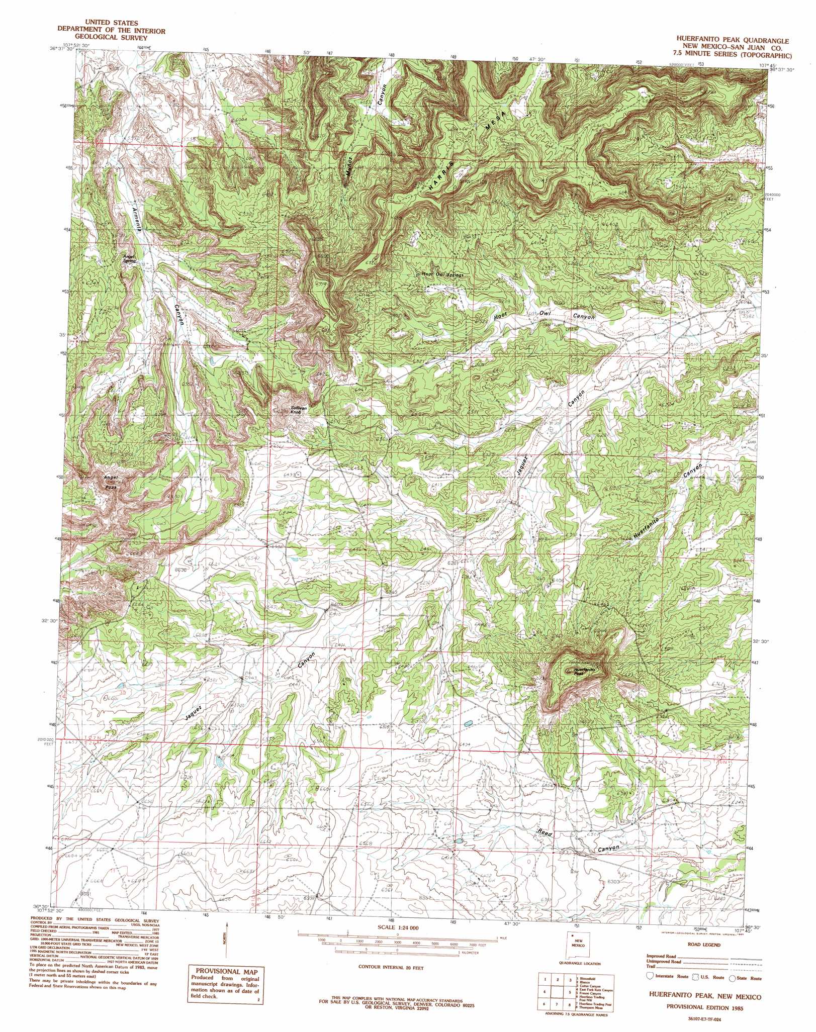
USGS Topo Quad 36107e7 - 1:24,000 scale
| Topo Map Name: | Huerfanito Peak |
| USGS Topo Quad ID: | 36107e7 |
| Print Size: | ca. 21 1/4" wide x 27" high |
| Southeast Coordinates: | 36.5° N latitude / 107.75° W longitude |
| Map Center Coordinates: | 36.5625° N latitude / 107.8125° W longitude |
| U.S. State: | NM |
| Filename: | o36107e7.jpg |
| Download Map JPG Image: | Huerfanito Peak topo map 1:24,000 scale |
| Map Type: | Topographic |
| Topo Series: | 7.5´ |
| Map Scale: | 1:24,000 |
| Source of Map Images: | United States Geological Survey (USGS) |
| Alternate Map Versions: |
Huerfanito Peak NM 1985, updated 1985 Download PDF Buy paper map Huerfanito Peak NM 2010 Download PDF Buy paper map Huerfanito Peak NM 2013 Download PDF Buy paper map Huerfanito Peak NM 2017 Download PDF Buy paper map |
1:24,000 Topo Quads surrounding Huerfanito Peak
Flora Vista |
Aztec |
Turley |
Archuleta |
Navajo Dam |
Horn Canyon |
Bloomfield |
Blanco |
Cutter Canyon |
Delgadito Mesa |
Gallegos Trading Post |
East Fork Kutz Canyon |
Huerfanito Peak |
Fresno Canyon |
Gould Pass |
Carson Trading Post |
Huerfano Trading Post Nw |
Huerfano Trading Post |
Thompson Mesa |
Smouse Mesa |
Alamo Mesa East |
Huerfano Trading Post Sw |
Blanco Trading Post |
Crow Mesa West |
Crow Mesa East |
> Back to 36107e1 at 1:100,000 scale
> Back to 36106a1 at 1:250,000 scale
> Back to U.S. Topo Maps home
Huerfanito Peak topo map: Gazetteer
Huerfanito Peak: Springs
Armenta Canyon Spring elevation 1844m 6049′Huerfanito Peak: Summits
Angel Peak elevation 2096m 6876′Harris Mesa elevation 2165m 7103′
Huerfanito Peak elevation 2180m 7152′
Huerfanito Peak digital topo map on disk
Buy this Huerfanito Peak topo map showing relief, roads, GPS coordinates and other geographical features, as a high-resolution digital map file on DVD: