Delgadito Mesa Topo Map New Mexico
To zoom in, hover over the map of Delgadito Mesa
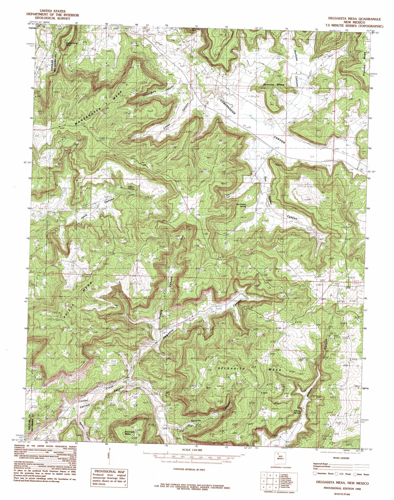
USGS Topo Quad 36107f5 - 1:24,000 scale
| Topo Map Name: | Delgadito Mesa |
| USGS Topo Quad ID: | 36107f5 |
| Print Size: | ca. 21 1/4" wide x 27" high |
| Southeast Coordinates: | 36.625° N latitude / 107.5° W longitude |
| Map Center Coordinates: | 36.6875° N latitude / 107.5625° W longitude |
| U.S. State: | NM |
| Filename: | o36107f5.jpg |
| Download Map JPG Image: | Delgadito Mesa topo map 1:24,000 scale |
| Map Type: | Topographic |
| Topo Series: | 7.5´ |
| Map Scale: | 1:24,000 |
| Source of Map Images: | United States Geological Survey (USGS) |
| Alternate Map Versions: |
Delgadita Mesa NM 1985, updated 1985 Download PDF Buy paper map Delgadita Mesa NM 1985, updated 1985 Download PDF Buy paper map Delgadita Mesa NM 2010 Download PDF Buy paper map Delgadita Mesa NM 2013 Download PDF Buy paper map |
1:24,000 Topo Quads surrounding Delgadito Mesa
Tank Mountain |
Anastacio Spring |
Burnt Mesa |
Bancos Mesa Nw |
Bancos Mesa |
Turley |
Archuleta |
Navajo Dam |
Gomez Ranch |
Espinosa Ranch |
Blanco |
Cutter Canyon |
Delgadito Mesa |
Fourmile Canyon |
Gobernador |
Huerfanito Peak |
Fresno Canyon |
Gould Pass |
Santos Peak |
Vigas Canyon |
Huerfano Trading Post |
Thompson Mesa |
Smouse Mesa |
Gonzales Mesa |
Lapis Point |
> Back to 36107e1 at 1:100,000 scale
> Back to 36106a1 at 1:250,000 scale
> Back to U.S. Topo Maps home
Delgadito Mesa topo map: Gazetteer
Delgadito Mesa: Summits
Delgadita Mesa elevation 2088m 6850′Delgadito Mesa: Valleys
Delgadita Canyon elevation 1820m 5971′Martin Canyon elevation 1809m 5935′
Delgadito Mesa digital topo map on disk
Buy this Delgadito Mesa topo map showing relief, roads, GPS coordinates and other geographical features, as a high-resolution digital map file on DVD: