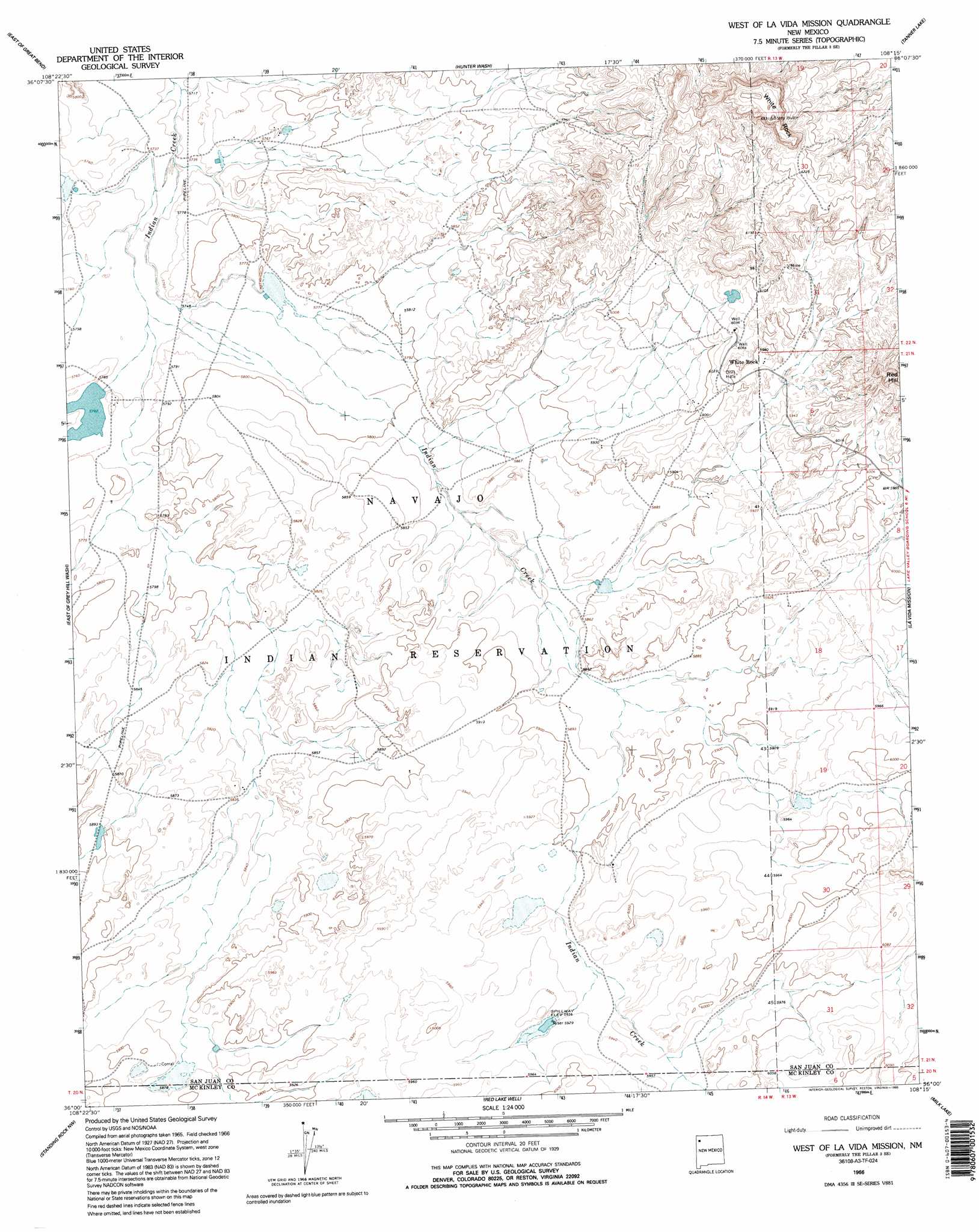
The Pillar 3 Se Topo Map New Mexico
To zoom in, hover over the map of The Pillar 3 Se
USGS Topo Quad 36108a3 - 1:24,000 scale
| Topo Map Name: | The Pillar 3 Se |
| USGS Topo Quad ID: | 36108a3 |
| Print Size: | ca. 21 1/4" wide x 27" high |
| Southeast Coordinates: | 36° N latitude / 108.25° W longitude |
| Map Center Coordinates: | 36.0625° N latitude / 108.3125° W longitude |
| U.S. State: | NM |
| Filename: | o36108a3.jpg |
| Download Map JPG Image: | The Pillar 3 Se topo map 1:24,000 scale |
| Map Type: | Topographic |
| Topo Series: | 7.5´ |
| Map Scale: | 1:24,000 |
| Source of Map Images: | United States Geological Survey (USGS) |
| Alternate Map Versions: |
The Pillar 3 SE NM 1966, updated 1969 Download PDF Buy paper map West Of La Vida Mission NM 1966, updated 1995 Download PDF Buy paper map West of La Vida Mission NM 2010 Download PDF Buy paper map West of La Vida Mission NM 2013 Download PDF Buy paper map West of La Vida Mission NM 2017 Download PDF Buy paper map |
1:24,000 Topo Quads surrounding The Pillar 3 Se
Newcomb Se |
Burnham Trading Post |
Bisti Trading Post |
Alamo Mesa West |
Alamo Mesa East |
Great Bend |
The Pillar 3 Nw |
The Pillar 3 Ne |
Tanner Lake |
Pretty Rock |
Grey Hill Spring |
The Pillar 2 Sw |
The Pillar 3 Se |
La Vida Mission |
Kin Klizhin Ruins |
Ear Rock |
Standing Rock Nw |
Red Lake Well |
Milk Lake |
Nose Rock |
Coyote Canyon |
Toyee |
Standing Rock |
Antelope Lookout Mesa |
Becenti Lake |
> Back to 36108a1 at 1:100,000 scale
> Back to 36108a1 at 1:250,000 scale
> Back to U.S. Topo Maps home
The Pillar 3 Se topo map: Gazetteer
The Pillar 3 Se: Populated Places
White Rock elevation 1820m 5971′The Pillar 3 Se: Summits
Red Hill elevation 1939m 6361′White Rock elevation 1983m 6505′
The Pillar 3 Se: Wells
15K-340 Water Well elevation 1799m 5902′The Pillar 3 Se digital topo map on disk
Buy this The Pillar 3 Se topo map showing relief, roads, GPS coordinates and other geographical features, as a high-resolution digital map file on DVD: