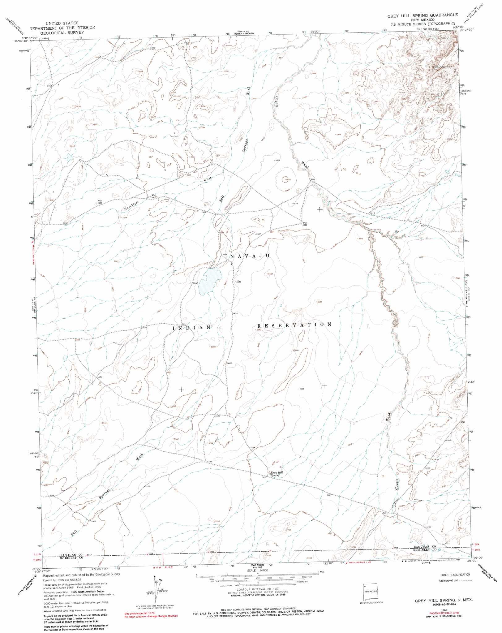
Grey Hill Spring Topo Map New Mexico
To zoom in, hover over the map of Grey Hill Spring
USGS Topo Quad 36108a5 - 1:24,000 scale
| Topo Map Name: | Grey Hill Spring |
| USGS Topo Quad ID: | 36108a5 |
| Print Size: | ca. 21 1/4" wide x 27" high |
| Southeast Coordinates: | 36° N latitude / 108.5° W longitude |
| Map Center Coordinates: | 36.0625° N latitude / 108.5625° W longitude |
| U.S. State: | NM |
| Filename: | o36108a5.jpg |
| Download Map JPG Image: | Grey Hill Spring topo map 1:24,000 scale |
| Map Type: | Topographic |
| Topo Series: | 7.5´ |
| Map Scale: | 1:24,000 |
| Source of Map Images: | United States Geological Survey (USGS) |
| Alternate Map Versions: |
Grey Hill Spring NM 1966, updated 1969 Download PDF Buy paper map Grey Hill Spring NM 1966, updated 1985 Download PDF Buy paper map Grey Hill Spring NM 2010 Download PDF Buy paper map Grey Hill Spring NM 2013 Download PDF Buy paper map Grey Hill Spring NM 2017 Download PDF Buy paper map |
1:24,000 Topo Quads surrounding Grey Hill Spring
Tsin-Nas-Kid |
Newcomb |
Newcomb Se |
Burnham Trading Post |
Bisti Trading Post |
Two Grey Hills |
Sheep Springs |
Great Bend |
The Pillar 3 Nw |
The Pillar 3 Ne |
Washington Pass |
Naschitti |
Grey Hill Spring |
The Pillar 2 Sw |
The Pillar 3 Se |
Chuska Peak |
Coyote Canyon Nw |
Ear Rock |
Standing Rock Nw |
Red Lake Well |
Tohatchi |
Chuska Lake |
Coyote Canyon |
Toyee |
Standing Rock |
> Back to 36108a1 at 1:100,000 scale
> Back to 36108a1 at 1:250,000 scale
> Back to U.S. Topo Maps home
Grey Hill Spring topo map: Gazetteer
Grey Hill Spring: Springs
Grey Hill Spring elevation 1738m 5702′Grey Hill Spring: Streams
Naschitti Wash elevation 1699m 5574′Tocito Wash elevation 1723m 5652′
Grey Hill Spring: Wells
14A-33 Water Well elevation 1706m 5597′14K-316 Water Well elevation 1708m 5603′
Grey Hill Spring digital topo map on disk
Buy this Grey Hill Spring topo map showing relief, roads, GPS coordinates and other geographical features, as a high-resolution digital map file on DVD: