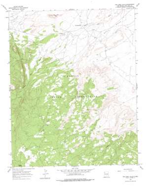
Two Grey Hills Topo Map New Mexico
To zoom in, hover over the map of Two Grey Hills
USGS Topo Quad 36108b7 - 1:24,000 scale
| Topo Map Name: | Two Grey Hills |
| USGS Topo Quad ID: | 36108b7 |
| Print Size: | ca. 21 1/4" wide x 27" high |
| Southeast Coordinates: | 36.125° N latitude / 108.75° W longitude |
| Map Center Coordinates: | 36.1875° N latitude / 108.8125° W longitude |
| U.S. State: | NM |
| Filename: | o36108b7.jpg |
| Download Map JPG Image: | Two Grey Hills topo map 1:24,000 scale |
| Map Type: | Topographic |
| Topo Series: | 7.5´ |
| Map Scale: | 1:24,000 |
| Source of Map Images: | United States Geological Survey (USGS) |
| Alternate Map Versions: |
Two Grey Hills NM 1966, updated 1969 Download PDF Buy paper map Two Grey Hills NM 1966, updated 1978 Download PDF Buy paper map Two Grey Hills NM 2010 Download PDF Buy paper map Two Grey Hills NM 2013 Download PDF Buy paper map Two Grey Hills NM 2017 Download PDF Buy paper map |
1:24,000 Topo Quads surrounding Two Grey Hills
> Back to 36108a1 at 1:100,000 scale
> Back to 36108a1 at 1:250,000 scale
> Back to U.S. Topo Maps home
Two Grey Hills topo map: Gazetteer
Two Grey Hills: Benches
Grey Mesa elevation 1793m 5882′Two Grey Hills: Populated Places
Two Grey Hills elevation 1794m 5885′Two Grey Hills: Springs
Mike Spring elevation 1854m 6082′Mormon Spring elevation 2435m 7988′
Two Grey Hills: Summits
Two Grey Hills elevation 1984m 6509′Two Grey Hills: Wells
12T-339 Water Well elevation 1782m 5846′12T-525 Water Well elevation 1796m 5892′
Sheep Sp N Water Well elevation 1791m 5875′
Two Grey Hills digital topo map on disk
Buy this Two Grey Hills topo map showing relief, roads, GPS coordinates and other geographical features, as a high-resolution digital map file on DVD:


