Gallegos Trading Post Topo Map New Mexico
To zoom in, hover over the map of Gallegos Trading Post
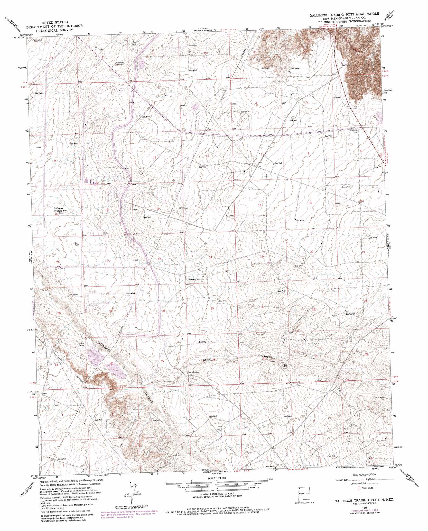
USGS Topo Quad 36108e1 - 1:24,000 scale
| Topo Map Name: | Gallegos Trading Post |
| USGS Topo Quad ID: | 36108e1 |
| Print Size: | ca. 21 1/4" wide x 27" high |
| Southeast Coordinates: | 36.5° N latitude / 108° W longitude |
| Map Center Coordinates: | 36.5625° N latitude / 108.0625° W longitude |
| U.S. State: | NM |
| Filename: | o36108e1.jpg |
| Download Map JPG Image: | Gallegos Trading Post topo map 1:24,000 scale |
| Map Type: | Topographic |
| Topo Series: | 7.5´ |
| Map Scale: | 1:24,000 |
| Source of Map Images: | United States Geological Survey (USGS) |
| Alternate Map Versions: |
Gallegos Trading Post NM 1965, updated 1969 Download PDF Buy paper map Gallegos Trading Post NM 1965, updated 1980 Download PDF Buy paper map Gallegos Trading Post NM 2010 Download PDF Buy paper map Gallegos Trading Post NM 2013 Download PDF Buy paper map Gallegos Trading Post NM 2017 Download PDF Buy paper map |
1:24,000 Topo Quads surrounding Gallegos Trading Post
Youngs Lake |
Farmington North |
Flora Vista |
Aztec |
Turley |
Kirtland |
Farmington South |
Horn Canyon |
Bloomfield |
Blanco |
Kirtland Se |
Hugh Lake |
Gallegos Trading Post |
East Fork Kutz Canyon |
Huerfanito Peak |
The Pillar |
Moncisco Wash |
Carson Trading Post |
Huerfano Trading Post Nw |
Huerfano Trading Post |
Bisti Trading Post |
Alamo Mesa West |
Alamo Mesa East |
Huerfano Trading Post Sw |
Blanco Trading Post |
> Back to 36108e1 at 1:100,000 scale
> Back to 36108a1 at 1:250,000 scale
> Back to U.S. Topo Maps home
Gallegos Trading Post topo map: Gazetteer
Gallegos Trading Post: Populated Places
Huerfano elevation 1888m 6194′Gallegos Trading Post: Springs
Pete Spring elevation 1805m 5921′Gallegos Trading Post: Valleys
Cedar Canyon elevation 1785m 5856′Gallegos Trading Post: Wells
19T-521 Water Well elevation 1796m 5892′Chaco Water Well elevation 1863m 6112′
Gallegos Trading Post digital topo map on disk
Buy this Gallegos Trading Post topo map showing relief, roads, GPS coordinates and other geographical features, as a high-resolution digital map file on DVD: