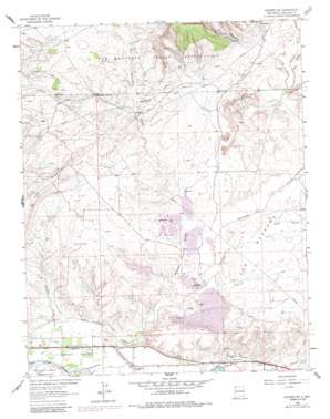
Waterflow Topo Map New Mexico
To zoom in, hover over the map of Waterflow
USGS Topo Quad 36108g4 - 1:24,000 scale
| Topo Map Name: | Waterflow |
| USGS Topo Quad ID: | 36108g4 |
| Print Size: | ca. 21 1/4" wide x 27" high |
| Southeast Coordinates: | 36.75° N latitude / 108.375° W longitude |
| Map Center Coordinates: | 36.8125° N latitude / 108.4375° W longitude |
| U.S. State: | NM |
| Filename: | o36108g4.jpg |
| Download Map JPG Image: | Waterflow topo map 1:24,000 scale |
| Map Type: | Topographic |
| Topo Series: | 7.5´ |
| Map Scale: | 1:24,000 |
| Source of Map Images: | United States Geological Survey (USGS) |
| Alternate Map Versions: |
Waterflow NM 1963, updated 1966 Download PDF Buy paper map Waterflow NM 1963, updated 1980 Download PDF Buy paper map Waterflow NM 1963, updated 1986 Download PDF Buy paper map Waterflow NM 2010 Download PDF Buy paper map Waterflow NM 2013 Download PDF Buy paper map Waterflow NM 2017 Download PDF Buy paper map |
1:24,000 Topo Quads surrounding Waterflow
> Back to 36108e1 at 1:100,000 scale
> Back to 36108a1 at 1:250,000 scale
> Back to U.S. Topo Maps home
Waterflow topo map: Gazetteer
Waterflow: Areas
The Meadows elevation 1603m 5259′Waterflow: Canals
Farmers Mutual Ditch elevation 1556m 5104′Jewett Valley Ditch elevation 1544m 5065′
Waterflow: Dams
San Juan Power Generation Dam elevation 1598m 5242′Waterflow: Mines
Abbe Young Mine elevation 1560m 5118′Adamson Mines elevation 1598m 5242′
Black Diamond Mines elevation 1599m 5246′
Brimhall Mine elevation 1602m 5255′
Hendrickson Mine elevation 1591m 5219′
Jack Boyd elevation 1699m 5574′
San Juan Underground Test Mine elevation 1586m 5203′
Scanlon Mine elevation 1589m 5213′
Smouse Mines elevation 1570m 5150′
Stalling Mine elevation 1589m 5213′
Walker Mine elevation 1560m 5118′
Waterflow Pit elevation 1560m 5118′
Waterflow: Oilfields
Verde Oil Field elevation 1628m 5341′Waterflow: Populated Places
Cottonwood elevation 1683m 5521′Waterflow: Post Offices
Waterflow Post Office elevation 1543m 5062′Waterflow: Reservoirs
San Juan Power Generation Reservoir elevation 1598m 5242′Waterflow: Springs
Mine Pit Spring elevation 1580m 5183′West Water Spring elevation 1646m 5400′
Westwater Spring elevation 1646m 5400′
Waterflow: Streams
Narrows Wash elevation 1616m 5301′Shumway Arroyo elevation 1537m 5042′
Waughan Arroyo elevation 1535m 5036′
Westwater Arroyo elevation 1574m 5164′
Waterflow: Valleys
Beechatuda Draw elevation 1627m 5337′Cottonwood Canyon elevation 1660m 5446′
Hutch Canyon elevation 1580m 5183′
Navajo Canyon elevation 1643m 5390′
Ute Canyon elevation 1660m 5446′
Waterflow: Wells
PS A Water Well elevation 1628m 5341′PS B Water Well elevation 1593m 5226′
SJ-23-4 Water Well elevation 1615m 5298′
Waterflow digital topo map on disk
Buy this Waterflow topo map showing relief, roads, GPS coordinates and other geographical features, as a high-resolution digital map file on DVD:


