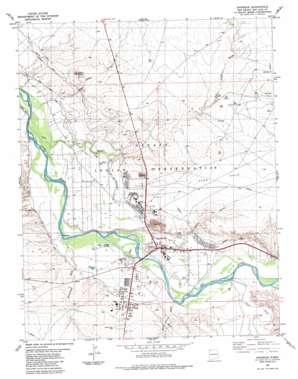
Shiprock Topo Map New Mexico
To zoom in, hover over the map of Shiprock
USGS Topo Quad 36108g6 - 1:24,000 scale
| Topo Map Name: | Shiprock |
| USGS Topo Quad ID: | 36108g6 |
| Print Size: | ca. 21 1/4" wide x 27" high |
| Southeast Coordinates: | 36.75° N latitude / 108.625° W longitude |
| Map Center Coordinates: | 36.8125° N latitude / 108.6875° W longitude |
| U.S. State: | NM |
| Filename: | o36108g6.jpg |
| Download Map JPG Image: | Shiprock topo map 1:24,000 scale |
| Map Type: | Topographic |
| Topo Series: | 7.5´ |
| Map Scale: | 1:24,000 |
| Source of Map Images: | United States Geological Survey (USGS) |
| Alternate Map Versions: |
Shiprock NM 1983, updated 1984 Download PDF Buy paper map Shiprock NM 2010 Download PDF Buy paper map Shiprock NM 2013 Download PDF Buy paper map Shiprock NM 2017 Download PDF Buy paper map |
1:24,000 Topo Quads surrounding Shiprock
> Back to 36108e1 at 1:100,000 scale
> Back to 36108a1 at 1:250,000 scale
> Back to U.S. Topo Maps home
Shiprock topo map: Gazetteer
Shiprock: Bridges
San Juan River Bridge Historic Site elevation 1492m 4895′Shiprock: Canals
Ditch Number Eight elevation 1507m 4944′Ditch Number Nine elevation 1480m 4855′
Shiprock: Mines
Blanchard Mine elevation 1543m 5062′Enos Johnson Mine elevation 1494m 4901′
Nelson Pit and Shady Side elevation 1494m 4901′
Shiprock Pit elevation 1494m 4901′
Shiprock: Populated Places
Shiprock elevation 1492m 4895′Shiprock: Post Offices
Shiprock Post Office elevation 1492m 4895′Shiprock: Streams
Baker Arroyo elevation 1519m 4983′Chaco River elevation 1499m 4917′
Many Devils Wash elevation 1494m 4901′
Rattlesnake Wash elevation 1481m 4858′
Salt Creek Wash elevation 1469m 4819′
Salt Creek Wash elevation 1471m 4826′
Yellow Arroyo elevation 1473m 4832′
Shiprock: Summits
Yellow Butte elevation 1569m 5147′Shiprock: Wells
12K-300A Water Well elevation 1500m 4921′12T-520 Water Well elevation 1507m 4944′
USIS Water Well elevation 1493m 4898′
Shiprock digital topo map on disk
Buy this Shiprock topo map showing relief, roads, GPS coordinates and other geographical features, as a high-resolution digital map file on DVD:


