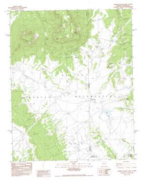
Sonsela Buttes Topo Map Arizona
To zoom in, hover over the map of Sonsela Buttes
USGS Topo Quad 36109a1 - 1:24,000 scale
| Topo Map Name: | Sonsela Buttes |
| USGS Topo Quad ID: | 36109a1 |
| Print Size: | ca. 21 1/4" wide x 27" high |
| Southeast Coordinates: | 36° N latitude / 109° W longitude |
| Map Center Coordinates: | 36.0625° N latitude / 109.0625° W longitude |
| U.S. States: | AZ, NM |
| Filename: | o36109a1.jpg |
| Download Map JPG Image: | Sonsela Buttes topo map 1:24,000 scale |
| Map Type: | Topographic |
| Topo Series: | 7.5´ |
| Map Scale: | 1:24,000 |
| Source of Map Images: | United States Geological Survey (USGS) |
| Alternate Map Versions: |
Sonsala Butte 4 SE AZ 1955, updated 1958 Download PDF Buy paper map Sonsela Buttes AZ 1983, updated 1983 Download PDF Buy paper map Sonsela Buttes AZ 1983, updated 1983 Download PDF Buy paper map Sonsela Buttes AZ 2010 Download PDF Buy paper map Sonsela Buttes AZ 2011 Download PDF Buy paper map Sonsela Buttes AZ 2014 Download PDF Buy paper map |
1:24,000 Topo Quads surrounding Sonsela Buttes
> Back to 36109a1 at 1:100,000 scale
> Back to 36108a1 at 1:250,000 scale
> Back to U.S. Topo Maps home
Sonsela Buttes topo map: Gazetteer
Sonsela Buttes: Bridges
White Bridge elevation 2215m 7267′Sonsela Buttes: Flats
Green Meadows elevation 2225m 7299′Sonsela Buttes: Gaps
Sunsela Saddle elevation 2366m 7762′Sonsela Buttes: Lakes
Black Lake elevation 2217m 7273′Sonsela Buttes: Mines
Chuska Mountain elevation 2257m 7404′Sonsela Buttes: Populated Places
Milkwater elevation 2228m 7309′Sonsela Buttes: Reservoirs
Sage Lake elevation 2227m 7306′Sonsela Buttes: Ridges
Black Rock Ridge elevation 2330m 7644′Sonsela Buttes: Springs
Black Salt Spring elevation 2236m 7335′Hidden Spring elevation 2252m 7388′
Oak Spring elevation 2281m 7483′
Salt Spring elevation 2207m 7240′
Sand Spring elevation 2280m 7480′
Star Peak Springs elevation 2336m 7664′
Sonsela Buttes: Streams
Crystal Creek elevation 2221m 7286′Sonsela Buttes: Summits
Sonsela Buttes elevation 2709m 8887′Sonsela Buttes: Valleys
Red Valley elevation 2242m 7355′Sonsela Buttes digital topo map on disk
Buy this Sonsela Buttes topo map showing relief, roads, GPS coordinates and other geographical features, as a high-resolution digital map file on DVD:


