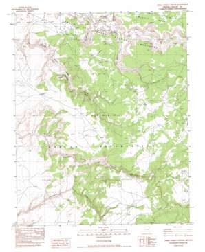
Three Turkey Canyon Topo Map Arizona
To zoom in, hover over the map of Three Turkey Canyon
USGS Topo Quad 36109a4 - 1:24,000 scale
| Topo Map Name: | Three Turkey Canyon |
| USGS Topo Quad ID: | 36109a4 |
| Print Size: | ca. 21 1/4" wide x 27" high |
| Southeast Coordinates: | 36° N latitude / 109.375° W longitude |
| Map Center Coordinates: | 36.0625° N latitude / 109.4375° W longitude |
| U.S. State: | AZ |
| Filename: | o36109a4.jpg |
| Download Map JPG Image: | Three Turkey Canyon topo map 1:24,000 scale |
| Map Type: | Topographic |
| Topo Series: | 7.5´ |
| Map Scale: | 1:24,000 |
| Source of Map Images: | United States Geological Survey (USGS) |
| Alternate Map Versions: |
Sonsala Butte 3 SW AZ 1955, updated 1958 Download PDF Buy paper map Three Turkey Canyon AZ 1983, updated 1983 Download PDF Buy paper map Three Turkey Canyon AZ 2011 Download PDF Buy paper map Three Turkey Canyon AZ 2014 Download PDF Buy paper map |
1:24,000 Topo Quads surrounding Three Turkey Canyon
> Back to 36109a1 at 1:100,000 scale
> Back to 36108a1 at 1:250,000 scale
> Back to U.S. Topo Maps home
Three Turkey Canyon topo map: Gazetteer
Three Turkey Canyon: Arches
The Window elevation 1905m 6250′Three Turkey Natural Bridge elevation 2003m 6571′
Three Turkey Canyon: Parks
Three Turkey Ruins Navajo Tribal Park elevation 2019m 6624′Three Turkey Canyon: Reservoirs
Tatezaka Tank elevation 1802m 5912′Three Turkey Canyon: Trails
Zuni Trail elevation 1979m 6492′Three Turkey Canyon: Valleys
Seachi Canyon elevation 0m 0′Spring Canyon elevation 1738m 5702′
Wild Cherry Canyon elevation 1750m 5741′
Three Turkey Canyon: Wells
Neboyias Water Well elevation 1747m 5731′Three Turkey Canyon digital topo map on disk
Buy this Three Turkey Canyon topo map showing relief, roads, GPS coordinates and other geographical features, as a high-resolution digital map file on DVD:


