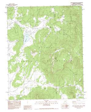
Upper Wheatfields Topo Map Arizona
To zoom in, hover over the map of Upper Wheatfields
USGS Topo Quad 36109b1 - 1:24,000 scale
| Topo Map Name: | Upper Wheatfields |
| USGS Topo Quad ID: | 36109b1 |
| Print Size: | ca. 21 1/4" wide x 27" high |
| Southeast Coordinates: | 36.125° N latitude / 109° W longitude |
| Map Center Coordinates: | 36.1875° N latitude / 109.0625° W longitude |
| U.S. States: | AZ, NM |
| Filename: | o36109b1.jpg |
| Download Map JPG Image: | Upper Wheatfields topo map 1:24,000 scale |
| Map Type: | Topographic |
| Topo Series: | 7.5´ |
| Map Scale: | 1:24,000 |
| Source of Map Images: | United States Geological Survey (USGS) |
| Alternate Map Versions: |
Sonsala Butte 4 NE AZ 1955, updated 1958 Download PDF Buy paper map Upper Wheatfields AZ 1983, updated 1983 Download PDF Buy paper map Upper Wheatfields AZ 2010 Download PDF Buy paper map Upper Wheatfields AZ 2011 Download PDF Buy paper map Upper Wheatfields AZ 2014 Download PDF Buy paper map |
1:24,000 Topo Quads surrounding Upper Wheatfields
> Back to 36109a1 at 1:100,000 scale
> Back to 36108a1 at 1:250,000 scale
> Back to U.S. Topo Maps home
Upper Wheatfields topo map: Gazetteer
Upper Wheatfields: Basins
Prairie Dog Valley elevation 2303m 7555′Yellow Valley elevation 2333m 7654′
Upper Wheatfields: Cliffs
Falling Iron Cliffs elevation 2730m 8956′Upper Wheatfields: Dams
Black Wood Dam elevation 2224m 7296′Little Whitecone Lake Dam elevation 2323m 7621′
Wheatfield Dam elevation 2223m 7293′
Upper Wheatfields: Lakes
Wheatfields Lake elevation 2223m 7293′Upper Wheatfields: Populated Places
Upper Wheatfields elevation 2258m 7408′Upper Wheatfields: Reservoirs
Little White Cone Lake elevation 2319m 7608′Upper Wheatfields: Springs
Horse Spring elevation 2227m 7306′Teddy Chee Spring elevation 2281m 7483′
Upper Wheatfields: Streams
Little Whiskey Creek elevation 2277m 7470′Upper Wheatfields: Summits
Little White Cone elevation 2515m 8251′White Cone elevation 2569m 8428′
Upper Wheatfields: Valleys
Bubbling Spring Valley elevation 2296m 7532′Upper Wheatfields digital topo map on disk
Buy this Upper Wheatfields topo map showing relief, roads, GPS coordinates and other geographical features, as a high-resolution digital map file on DVD:


