Tall Tree Mesa Topo Map Arizona
To zoom in, hover over the map of Tall Tree Mesa
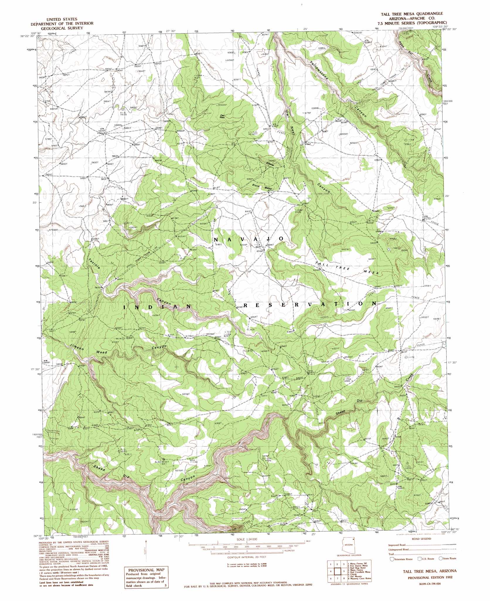
USGS Topo Quad 36109c4 - 1:24,000 scale
| Topo Map Name: | Tall Tree Mesa |
| USGS Topo Quad ID: | 36109c4 |
| Print Size: | ca. 21 1/4" wide x 27" high |
| Southeast Coordinates: | 36.25° N latitude / 109.375° W longitude |
| Map Center Coordinates: | 36.3125° N latitude / 109.4375° W longitude |
| U.S. State: | AZ |
| Filename: | o36109c4.jpg |
| Download Map JPG Image: | Tall Tree Mesa topo map 1:24,000 scale |
| Map Type: | Topographic |
| Topo Series: | 7.5´ |
| Map Scale: | 1:24,000 |
| Source of Map Images: | United States Geological Survey (USGS) |
| Alternate Map Versions: |
Sonsala Butte 2 SW AZ 1955, updated 1958 Download PDF Buy paper map Tall Tree Mesa AZ 1982, updated 1982 Download PDF Buy paper map Tall Tree Mesa AZ 2011 Download PDF Buy paper map Tall Tree Mesa AZ 2014 Download PDF Buy paper map |
1:24,000 Topo Quads surrounding Tall Tree Mesa
Rock Point Sw |
Little Round Rock |
Round Rock |
Mexican Cry Mesa |
Cove |
Windy Valley |
Many Farms Ne |
Fire Dance Mesa |
Bad Bug Butte |
Lukachukai |
Many Farms Sw |
Many Farms |
Tall Tree Mesa |
Red Cornfield Mesa |
Tsaile |
Ventana Mesa |
Chinle |
Del Merto |
Mummy Cave Ruins |
Lower Wheatfields |
Toh De Niihe |
Little White House Ruins |
Three Turkey Canyon |
Spider Rock |
White Clay |
> Back to 36109a1 at 1:100,000 scale
> Back to 36108a1 at 1:250,000 scale
> Back to U.S. Topo Maps home
Tall Tree Mesa topo map: Gazetteer
Tall Tree Mesa: Summits
Bilasha elevation 1909m 6263′Owl Nest elevation 1860m 6102′
Tall Tree Mesa elevation 1999m 6558′
Tall Tree Mesa digital topo map on disk
Buy this Tall Tree Mesa topo map showing relief, roads, GPS coordinates and other geographical features, as a high-resolution digital map file on DVD: