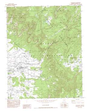
Lukachukai Topo Map Arizona
To zoom in, hover over the map of Lukachukai
USGS Topo Quad 36109d2 - 1:24,000 scale
| Topo Map Name: | Lukachukai |
| USGS Topo Quad ID: | 36109d2 |
| Print Size: | ca. 21 1/4" wide x 27" high |
| Southeast Coordinates: | 36.375° N latitude / 109.125° W longitude |
| Map Center Coordinates: | 36.4375° N latitude / 109.1875° W longitude |
| U.S. State: | AZ |
| Filename: | o36109d2.jpg |
| Download Map JPG Image: | Lukachukai topo map 1:24,000 scale |
| Map Type: | Topographic |
| Topo Series: | 7.5´ |
| Map Scale: | 1:24,000 |
| Source of Map Images: | United States Geological Survey (USGS) |
| Alternate Map Versions: |
Sonsala Butte 1 NW AZ 1955, updated 1958 Download PDF Buy paper map Lukachukai AZ 1982, updated 1982 Download PDF Buy paper map Lukachukai AZ 2011 Download PDF Buy paper map Lukachukai AZ 2014 Download PDF Buy paper map |
1:24,000 Topo Quads surrounding Lukachukai
> Back to 36109a1 at 1:100,000 scale
> Back to 36108a1 at 1:250,000 scale
> Back to U.S. Topo Maps home
Lukachukai topo map: Gazetteer
Lukachukai: Gaps
Buffalo Pass elevation 2573m 8441′Lukachukai: Lakes
Big Lake elevation 2668m 8753′Lukachukai: Mines
Camp Mine elevation 2378m 7801′Cisco Mine elevation 2373m 7785′
Joleo Mine elevation 2384m 7821′
Knife Edge Mesa Mine elevation 2392m 7847′
Lukachukai: Populated Places
Lukachukai elevation 1993m 6538′Lukachukai: Post Offices
Lukachukai Post Office elevation 1953m 6407′Lukachukai: Ranges
Lukachukai Mountains elevation 2589m 8494′Lukachukai: Springs
Aspen Spring elevation 2612m 8569′Wild Geese Nest Spring elevation 2667m 8750′
Lukachukai: Streams
Lizard Wash elevation 1951m 6400′Lukachukai: Wells
Small Creek Well elevation 2013m 6604′Lukachukai digital topo map on disk
Buy this Lukachukai topo map showing relief, roads, GPS coordinates and other geographical features, as a high-resolution digital map file on DVD:


