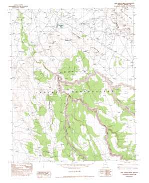
Fire Dance Mesa Topo Map Arizona
To zoom in, hover over the map of Fire Dance Mesa
USGS Topo Quad 36109d4 - 1:24,000 scale
| Topo Map Name: | Fire Dance Mesa |
| USGS Topo Quad ID: | 36109d4 |
| Print Size: | ca. 21 1/4" wide x 27" high |
| Southeast Coordinates: | 36.375° N latitude / 109.375° W longitude |
| Map Center Coordinates: | 36.4375° N latitude / 109.4375° W longitude |
| U.S. State: | AZ |
| Filename: | o36109d4.jpg |
| Download Map JPG Image: | Fire Dance Mesa topo map 1:24,000 scale |
| Map Type: | Topographic |
| Topo Series: | 7.5´ |
| Map Scale: | 1:24,000 |
| Source of Map Images: | United States Geological Survey (USGS) |
| Alternate Map Versions: |
Sonsala Butte 2 NW AZ 1955, updated 1958 Download PDF Buy paper map Fire Dance Mesa AZ 1982, updated 1982 Download PDF Buy paper map Fire Dance Mesa AZ 2011 Download PDF Buy paper map Fire Dance Mesa AZ 2014 Download PDF Buy paper map |
1:24,000 Topo Quads surrounding Fire Dance Mesa
> Back to 36109a1 at 1:100,000 scale
> Back to 36108a1 at 1:250,000 scale
> Back to U.S. Topo Maps home
Fire Dance Mesa topo map: Gazetteer
Fire Dance Mesa: Cliffs
Tsekadebehgon elevation 1750m 5741′Fire Dance Mesa: Dams
Round Rock Dam elevation 1630m 5347′Fire Dance Mesa: Reservoirs
Round Rock Lake elevation 1630m 5347′Round Rock Reservoir elevation 0m 0′
Fire Dance Mesa: Ridges
Brown Ridge elevation 1773m 5816′Gray Ridge elevation 1719m 5639′
Fire Dance Mesa: Springs
Broken Iron Spring elevation 1658m 5439′Fire Dance Mesa: Streams
Agua Sal Creek elevation 1645m 5396′Fire Dance Mesa: Summits
Big Mountain elevation 1770m 5807′Blue Hill elevation 1706m 5597′
Salt Water Cone elevation 1754m 5754′
Tseyah elevation 1837m 6026′
Fire Dance Mesa: Valleys
Bihilinie Canyon elevation 1710m 5610′Owl Nest Canyon elevation 1835m 6020′
Tsedatoh Canyon elevation 1788m 5866′
Yellowstone Canyon elevation 1752m 5748′
Fire Dance Mesa digital topo map on disk
Buy this Fire Dance Mesa topo map showing relief, roads, GPS coordinates and other geographical features, as a high-resolution digital map file on DVD:


