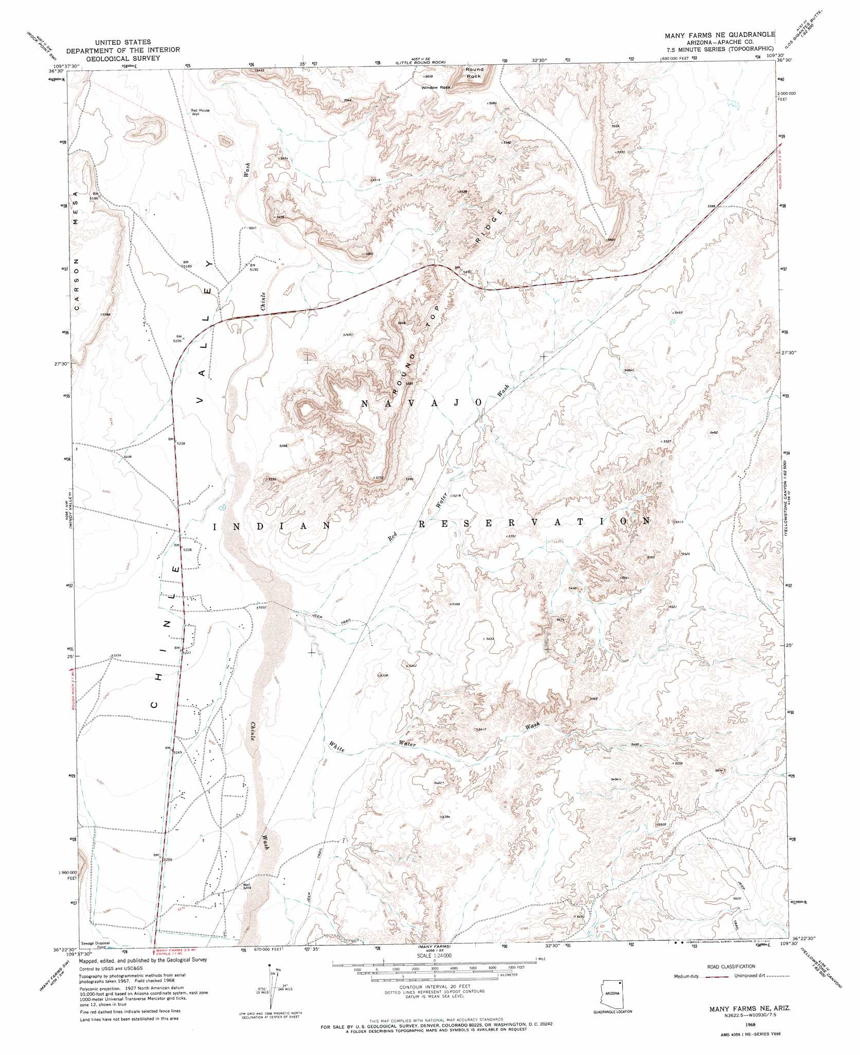
Many Farms Ne Topo Map Arizona
To zoom in, hover over the map of Many Farms Ne
USGS Topo Quad 36109d5 - 1:24,000 scale
| Topo Map Name: | Many Farms Ne |
| USGS Topo Quad ID: | 36109d5 |
| Print Size: | ca. 21 1/4" wide x 27" high |
| Southeast Coordinates: | 36.375° N latitude / 109.5° W longitude |
| Map Center Coordinates: | 36.4375° N latitude / 109.5625° W longitude |
| U.S. State: | AZ |
| Filename: | o36109d5.jpg |
| Download Map JPG Image: | Many Farms Ne topo map 1:24,000 scale |
| Map Type: | Topographic |
| Topo Series: | 7.5´ |
| Map Scale: | 1:24,000 |
| Source of Map Images: | United States Geological Survey (USGS) |
| Alternate Map Versions: |
Many Farms NE AZ 1968, updated 1972 Download PDF Buy paper map Many Farms NE AZ 2011 Download PDF Buy paper map Many Farms NE AZ 2014 Download PDF Buy paper map |
1:24,000 Topo Quads surrounding Many Farms Ne
Tall Mesa |
Rock Point |
Dancing Rocks |
White Area Canyon |
Kinusta Mesa |
White Point |
Rock Point Sw |
Little Round Rock |
Round Rock |
Mexican Cry Mesa |
Rough Rock |
Windy Valley |
Many Farms Ne |
Fire Dance Mesa |
Bad Bug Butte |
Sweathouse Peak |
Many Farms Sw |
Many Farms |
Tall Tree Mesa |
Red Cornfield Mesa |
Lohali Point |
Ventana Mesa |
Chinle |
Del Merto |
Mummy Cave Ruins |
> Back to 36109a1 at 1:100,000 scale
> Back to 36108a1 at 1:250,000 scale
> Back to U.S. Topo Maps home
Many Farms Ne topo map: Gazetteer
Many Farms Ne: Arches
Window Rock elevation 1804m 5918′Many Farms Ne: Ridges
Round Top Ridge elevation 0m 0′Many Farms Ne: Summits
Window Rock elevation 1776m 5826′Many Farms Ne: Valleys
Red Water Wash elevation 1597m 5239′White Water Wash elevation 1595m 5232′
Many Farms Ne: Wells
Red House Well elevation 1577m 5173′Many Farms Ne digital topo map on disk
Buy this Many Farms Ne topo map showing relief, roads, GPS coordinates and other geographical features, as a high-resolution digital map file on DVD: