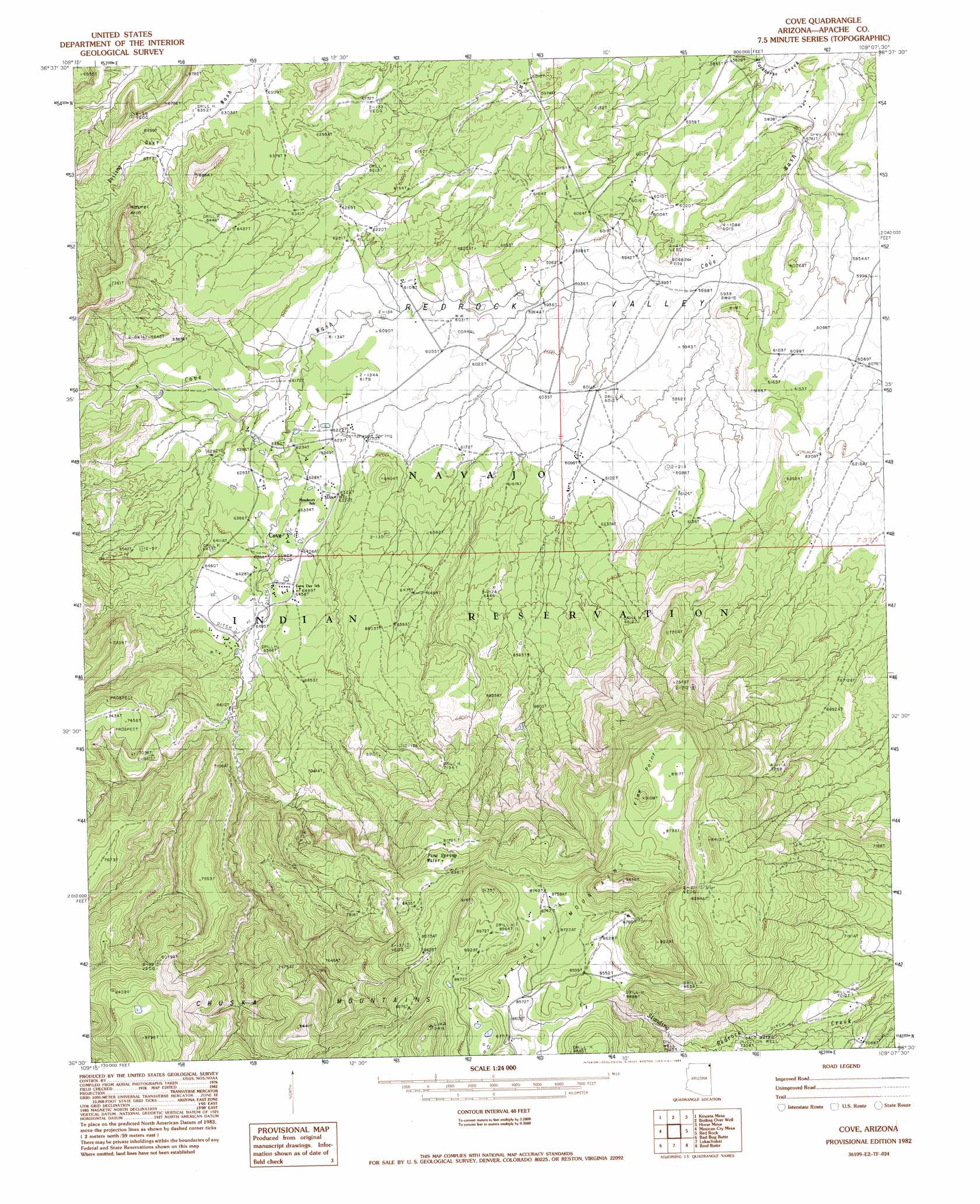
Cove Topo Map Arizona
To zoom in, hover over the map of Cove
USGS Topo Quad 36109e2 - 1:24,000 scale
| Topo Map Name: | Cove |
| USGS Topo Quad ID: | 36109e2 |
| Print Size: | ca. 21 1/4" wide x 27" high |
| Southeast Coordinates: | 36.5° N latitude / 109.125° W longitude |
| Map Center Coordinates: | 36.5625° N latitude / 109.1875° W longitude |
| U.S. State: | AZ |
| Filename: | o36109e2.jpg |
| Download Map JPG Image: | Cove topo map 1:24,000 scale |
| Map Type: | Topographic |
| Topo Series: | 7.5´ |
| Map Scale: | 1:24,000 |
| Source of Map Images: | United States Geological Survey (USGS) |
| Alternate Map Versions: |
Redrock Valley SW AZ 1953, updated 1954 Download PDF Buy paper map Cove AZ 1982, updated 1983 Download PDF Buy paper map Cove AZ 2011 Download PDF Buy paper map Cove AZ 2014 Download PDF Buy paper map |
1:24,000 Topo Quads surrounding Cove
Walker Butte |
Toh Chin Lini Mesa |
Pastora Peak |
Beclabito |
Rocky Point |
White Area Canyon |
Kinusta Mesa |
Boiling Over Well |
Horse Mesa |
Sand Spring |
Round Rock |
Mexican Cry Mesa |
Cove |
Red Valley |
Mitten Rock |
Fire Dance Mesa |
Bad Bug Butte |
Lukachukai |
Roof Butte |
Sanostee West |
Tall Tree Mesa |
Red Cornfield Mesa |
Tsaile |
Tsaile Butte |
Old Pine Spring |
> Back to 36109e1 at 1:100,000 scale
> Back to 36108a1 at 1:250,000 scale
> Back to U.S. Topo Maps home
Cove topo map: Gazetteer
Cove: Arches
Royal Arch elevation 2067m 6781′Cove: Populated Places
Cove elevation 1943m 6374′Yazzi elevation 1902m 6240′
Cove: Springs
Cottonwood Spring elevation 1893m 6210′Pine Water Spring elevation 2487m 8159′
Cove: Summits
View Point elevation 2772m 9094′Cove: Wells
Grey Hill Well elevation 1756m 5761′Cove digital topo map on disk
Buy this Cove topo map showing relief, roads, GPS coordinates and other geographical features, as a high-resolution digital map file on DVD: