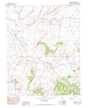
Walker Butte Topo Map Arizona
To zoom in, hover over the map of Walker Butte
USGS Topo Quad 36109g4 - 1:24,000 scale
| Topo Map Name: | Walker Butte |
| USGS Topo Quad ID: | 36109g4 |
| Print Size: | ca. 21 1/4" wide x 27" high |
| Southeast Coordinates: | 36.75° N latitude / 109.375° W longitude |
| Map Center Coordinates: | 36.8125° N latitude / 109.4375° W longitude |
| U.S. State: | AZ |
| Filename: | o36109g4.jpg |
| Download Map JPG Image: | Walker Butte topo map 1:24,000 scale |
| Map Type: | Topographic |
| Topo Series: | 7.5´ |
| Map Scale: | 1:24,000 |
| Source of Map Images: | United States Geological Survey (USGS) |
| Alternate Map Versions: |
Dinne Mesa SW AZ 1953, updated 1954 Download PDF Buy paper map Walker Butte AZ 1982, updated 1983 Download PDF Buy paper map Walker Butte AZ 2011 Download PDF Buy paper map Walker Butte AZ 2014 Download PDF Buy paper map |
1:24,000 Topo Quads surrounding Walker Butte
> Back to 36109e1 at 1:100,000 scale
> Back to 36108a1 at 1:250,000 scale
> Back to U.S. Topo Maps home
Walker Butte topo map: Gazetteer
Walker Butte: Populated Places
Emmanuel Mission elevation 1667m 5469′Totacon elevation 1630m 5347′
Walker Butte: Springs
Salt Spring elevation 1661m 5449′Walker Butte: Streams
Kit Sili Wash elevation 1598m 5242′Sweetwater Wash elevation 1573m 5160′
Walker Butte: Summits
Tseh Any elevation 1725m 5659′Walker Butte elevation 1840m 6036′
Walker Butte: Valleys
Alcove Canyon elevation 1613m 5291′Tseligaideeza Canyon elevation 0m 0′
Walker Butte digital topo map on disk
Buy this Walker Butte topo map showing relief, roads, GPS coordinates and other geographical features, as a high-resolution digital map file on DVD:


