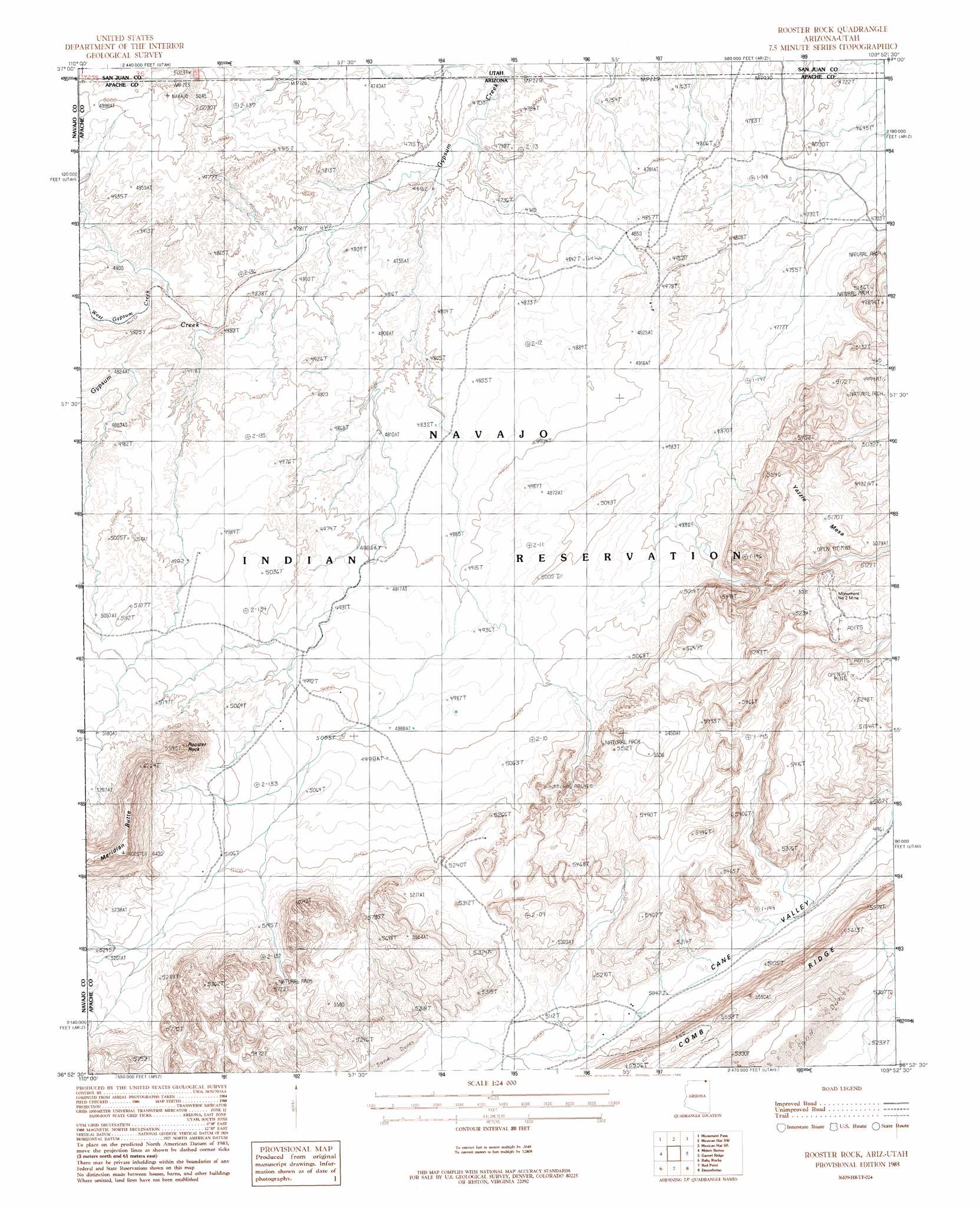
Rooster Rock Topo Map Arizona
To zoom in, hover over the map of Rooster Rock
USGS Topo Quad 36109h8 - 1:24,000 scale
| Topo Map Name: | Rooster Rock |
| USGS Topo Quad ID: | 36109h8 |
| Print Size: | ca. 21 1/4" wide x 27" high |
| Southeast Coordinates: | 36.875° N latitude / 109.875° W longitude |
| Map Center Coordinates: | 36.9375° N latitude / 109.9375° W longitude |
| U.S. States: | AZ, UT |
| Filename: | o36109h8.jpg |
| Download Map JPG Image: | Rooster Rock topo map 1:24,000 scale |
| Map Type: | Topographic |
| Topo Series: | 7.5´ |
| Map Scale: | 1:24,000 |
| Source of Map Images: | United States Geological Survey (USGS) |
| Alternate Map Versions: |
Setsiltso Springs 2 NW AZ 1952, updated 1954 Download PDF Buy paper map Rooster Rock AZ 1988, updated 1988 Download PDF Buy paper map Rooster Rock AZ 2011 Download PDF Buy paper map Rooster Rock AZ 2011 Download PDF Buy paper map Rooster Rock AZ 2014 Download PDF Buy paper map |
1:24,000 Topo Quads surrounding Rooster Rock
Goulding Nw |
Goulding Ne |
The Goosenecks |
Mexican Hat |
San Juan Hill |
Goulding |
Monument Pass |
Mexican Hat Sw |
Mexican Hat Se |
Moses Rock |
Mystery Valley |
Mitten Buttes |
Rooster Rock |
Garnet Ridge |
Mexican Water |
Agathla Peak |
Baby Rocks |
Red Point |
Dennehotso |
Mexican Water Sw |
Kayenta East |
Church Rock |
Red Point Mesa |
Tall Mesa |
Rock Point |
> Back to 36109e1 at 1:100,000 scale
> Back to 36108a1 at 1:250,000 scale
> Back to U.S. Topo Maps home
Rooster Rock topo map: Gazetteer
Rooster Rock: Arches
Forbidden Arch elevation 1532m 5026′Genevieves Arch elevation 1641m 5383′
Natural Arch elevation 1652m 5419′
Natural Arch elevation 1558m 5111′
Natural Arch elevation 1558m 5111′
Skeleton Arch elevation 1671m 5482′
Sunrise Arch elevation 1648m 5406′
Rooster Rock: Basins
Monument Valley elevation 1509m 4950′Rooster Rock: Mines
Monument Number Two Tunnel elevation 1580m 5183′Rooster Rock: Streams
West Gypsum Creek elevation 1465m 4806′Rooster Rock: Summits
Rooster Rock elevation 1720m 5643′Yazzie Mesa elevation 1629m 5344′
Rooster Rock digital topo map on disk
Buy this Rooster Rock topo map showing relief, roads, GPS coordinates and other geographical features, as a high-resolution digital map file on DVD: