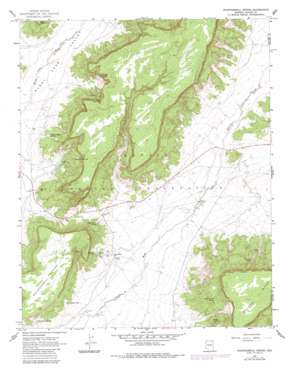
Whippoorwill Spring Topo Map Arizona
To zoom in, hover over the map of Whippoorwill Spring
USGS Topo Quad 36110a1 - 1:24,000 scale
| Topo Map Name: | Whippoorwill Spring |
| USGS Topo Quad ID: | 36110a1 |
| Print Size: | ca. 21 1/4" wide x 27" high |
| Southeast Coordinates: | 36° N latitude / 110° W longitude |
| Map Center Coordinates: | 36.0625° N latitude / 110.0625° W longitude |
| U.S. State: | AZ |
| Filename: | o36110a1.jpg |
| Download Map JPG Image: | Whippoorwill Spring topo map 1:24,000 scale |
| Map Type: | Topographic |
| Topo Series: | 7.5´ |
| Map Scale: | 1:24,000 |
| Source of Map Images: | United States Geological Survey (USGS) |
| Alternate Map Versions: |
Whippoorwill Spring AZ 1967, updated 1969 Download PDF Buy paper map Whippoorwill Spring AZ 1967, updated 1983 Download PDF Buy paper map Whippoorwill Spring AZ 2011 Download PDF Buy paper map Whippoorwill Spring AZ 2014 Download PDF Buy paper map |
1:24,000 Topo Quads surrounding Whippoorwill Spring
> Back to 36110a1 at 1:100,000 scale
> Back to 36110a1 at 1:250,000 scale
> Back to U.S. Topo Maps home
Whippoorwill Spring topo map: Gazetteer
Whippoorwill Spring: Areas
Navajo Country elevation 2006m 6581′Whippoorwill Spring: Springs
Deneth Chahis Spring elevation 1926m 6318′Doh Yai Nos Cly elevation 1993m 6538′
Donkey Spring elevation 2020m 6627′
Peaches Spring elevation 2007m 6584′
Sei Betoh elevation 0m 0′
Smoke Signal Spring elevation 2032m 6666′
Whippoorwill Spring elevation 1926m 6318′
White Horse Spring elevation 1944m 6377′
Willa Zhinni Toh elevation 1896m 6220′
Woosh Clo Dee Toh elevation 1890m 6200′
Whippoorwill Spring: Summits
Whippoorwill Spring Mesa elevation 2000m 6561′Whippoorwill Spring: Wells
Little Water Well elevation 1911m 6269′Tom Hunters Well elevation 1928m 6325′
Whippoorwill Spring digital topo map on disk
Buy this Whippoorwill Spring topo map showing relief, roads, GPS coordinates and other geographical features, as a high-resolution digital map file on DVD:


